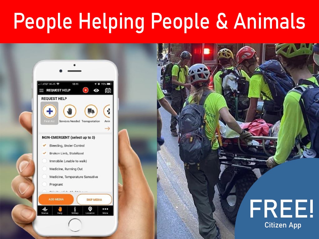
A flooded road is not just a flooded road. It may block an ambulance route, isolate residents, delay utility crews, and leave a volunteer team headed toward a location it cannot reach. During a disaster, the quality of each field report affects the next operational decision. A disaster damage assessment reporting app gives emergency teams a structured way to collect those reports, verify what matters, and turn local observations into coordinated action.
The goal is not to replace professional damage assessments, incident command procedures, or agency judgment. It is to reduce the time between a resident, volunteer, or field supervisor seeing a problem and the right person having enough information to act on it.
Why Damage Reporting Breaks Down in the Field
Most organizations do not struggle because people fail to notice damage. They struggle because reports arrive through too many disconnected channels. A resident posts a photo on social media. A volunteer sends a text. A field team calls dispatch. A partner organization adds notes to a spreadsheet. By the time those reports are compared, duplicate requests, missing locations, and outdated conditions can cloud the operational picture.
This creates avoidable pressure on emergency managers and dispatch leaders. They need to know what happened, where it happened, who may be affected, whether the report has been verified, and what resource should respond. A message that says, “Tree down by the school,” is useful as an initial alert. It is not enough to safely assign a crew without a precise location, current photo, access information, and status.
A purpose-built reporting workflow gives every report a consistent path. Information enters the system, is reviewed against the broader incident picture, and is routed to the team or agency responsible for the next step. That structure matters when the volume rises from a handful of reports to hundreds across multiple neighborhoods.
What a Disaster Damage Assessment Reporting App Should Capture
The best reporting tools make it easy for people to submit useful information without forcing them to understand emergency-management terminology. A resident may only know that water is entering a home, a road is impassable, or an elderly neighbor needs help. The app should guide the person toward the details responders need while keeping the reporting process clear and safe.
At a minimum, a report should capture the incident type, location, time observed, narrative details, and supporting photos when available. Location can be entered by address or mapped from the device, depending on connectivity and the reporter’s circumstances. Status fields are equally important. Teams need to distinguish between a newly submitted report, a report under review, an assigned task, a resolved issue, and a duplicate or unverified submission.
The data model should also reflect the reality that damage and human needs are connected. A wind-damaged roof may create a shelter need. A blocked driveway may prevent a resident from receiving medication or a responder from reaching an animal in distress. Rather than treating property damage as a separate administrative task, the reporting system should support a fuller operational view of conditions, needs, and available resources.
Keep Public Reporting Simple, Keep Operations Detailed
There is a practical balance to maintain. Public-facing forms should be simple enough to use under stress, often from a phone with limited battery or unreliable service. Internal workflows can be more detailed because trained personnel need to classify severity, identify jurisdiction, document actions, and preserve records for recovery reporting.
This two-level approach protects participation without sacrificing accountability. Citizens can report what they see. Authorized teams can validate the report, add operational notes, attach work orders, and manage sensitive information according to agency policy.
From Report Intake to Actionable Situational Awareness
Collecting reports is only the first step. The real operational value comes from seeing those reports in context.
A mapped view can show where road closures overlap with welfare-check requests, where power outages are affecting medically vulnerable areas, or where multiple debris reports point to a blocked evacuation route. This helps incident coordinators prioritize based on life safety, access, scale, and available resources rather than relying on the order in which messages arrived.
For example, after a severe storm, five residents may report separate fallen trees near the same intersection. A coordinated system can help staff identify the pattern, verify the location, and create one assignment for the appropriate crew rather than dispatching multiple teams to the same hazard. Conversely, reports that appear similar may require different actions. A tree across a sidewalk and a tree on energized power lines should not follow the same escalation path.
Situational awareness also depends on time. Conditions change quickly after floods, wildfires, tornadoes, and hurricanes. A reporting app should retain timestamps and updates so teams can see whether a condition is current, worsening, resolved, or waiting for verification. That history supports better decision-making during the incident and clearer documentation afterward.
Build a Workflow That Fits Your Response Structure
No two communities organize disaster operations in exactly the same way. A county emergency management department may coordinate municipal agencies, utilities, and voluntary organizations. A CERT program may depend on trained volunteers and neighborhood reporting. An NGO may focus on shelter support, distribution, or survivor assistance. The right workflow depends on mission, authority, staffing, and the type of incident.
Still, effective workflows tend to follow a common sequence: receive the report, triage it, verify when needed, assign responsibility, communicate status, and document the outcome. Each handoff should be visible. If a report is assigned to a field supervisor, dispatch and command staff should be able to see that assignment. If the issue falls outside the organization’s authority, it should be routed or referred without disappearing from the record.
A disaster damage assessment reporting app should connect naturally with work orders, dispatch activity, volunteer assignments, community alerts, and operational mapping. When those functions live in separate tools, teams spend time copying information rather than managing the incident. When they work together, a verified report can become a task, a task can be assigned to an eligible responder, and the outcome can update the shared operational picture.
PubSafe supports this type of connected workflow by bringing citizen reporting, field coordination, volunteer management, requests, work orders, and live mapping into one operational environment.
Protect Sensitive Information Without Slowing Response
Damage reporting can involve personal addresses, contact details, medical concerns, images of private property, and details about vulnerable residents. That information should not be handled casually or distributed to every user by default.
Role-based access is essential. Dispatch leaders may need full case detail, while a field team may only need the assignment information required to complete a task. Volunteer coordinators may need to confirm availability and qualifications without seeing protected household information. Clear permissions reduce unnecessary exposure while allowing people to do their jobs.
Security also includes operational discipline. Agencies should define who can close a report, who can alter assessment categories, how duplicate reports are handled, and how records are retained. The software should support those policies, but technology cannot substitute for a documented process and trained users.
Prepare Before the Next Incident
A reporting app delivers its best results when it is configured before blue-sky conditions turn gray. Waiting until a major event to decide which report categories to use, who receives alerts, or how volunteers will be assigned creates confusion at the exact moment clarity is most needed.
Before an incident, organizations should set up common hazard categories, reporting questions, priority rules, agency contacts, and escalation paths. They should also test the workflow with a realistic exercise. Ask participants to submit reports for blocked roads, flooding, utility hazards, assistance needs, and duplicate incidents. Then review where information was incomplete, where routing stalled, and where staff lacked visibility.
Training should extend beyond the operations center. Residents need simple guidance about when to call 911, when to use a non-emergency reporting tool, and what details make a report useful. Volunteers need clear instructions about safety boundaries, documentation, and when to elevate an issue. A larger reporting network is valuable only when participants know how to contribute safely.
Measure What Improves Response
After an event, reporting data can reveal far more than the total number of damaged structures or open requests. It can show the time from submission to review, the percentage of reports with usable location data, recurring problem areas, duplicate-report patterns, and the duration of unresolved tasks.
Those measures should be used with care. Fast closure is not always the same as effective service, particularly when an issue requires another agency, contractor, or long-term recovery resource. The more meaningful question is whether the organization moved each report toward an appropriate outcome and maintained clear communication with the people affected.
A well-designed reporting program turns residents into informed partners, gives field teams a better view of their assignments, and helps command staff make decisions from a shared record instead of scattered messages. The next storm, fire, or flood will still create uncertainty. Your reporting process should not add to it.