Government
Crowd-Sourced & Real-Time
Thank you for reading this post, don't forget to install the free PubSafe mobile app and subscribe!
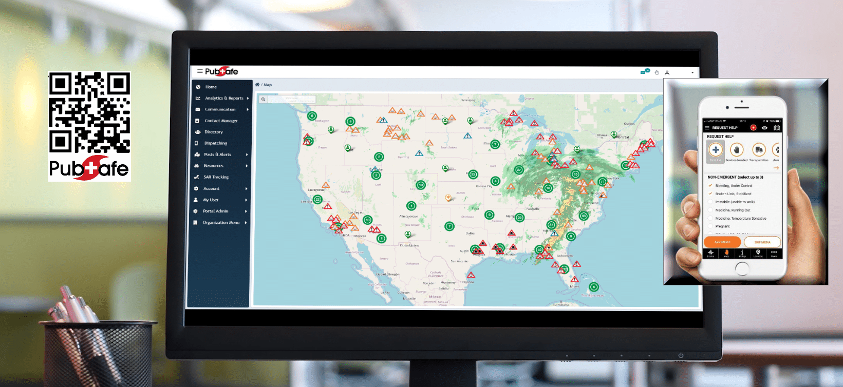
Global Real-time & Crowd-Sourced Data
PubSafeTM is bringing emergency management real-time data which can be used in a wide variety of scenarios. Data collected by the PubSafeTM mobile app bridges the information silos between local, state, federal (FEMA), NGOs and corporate organizations. When decisions are efficient, lives and money can be saved.
- PubSafe mobile app citizen users crowdsource live data.
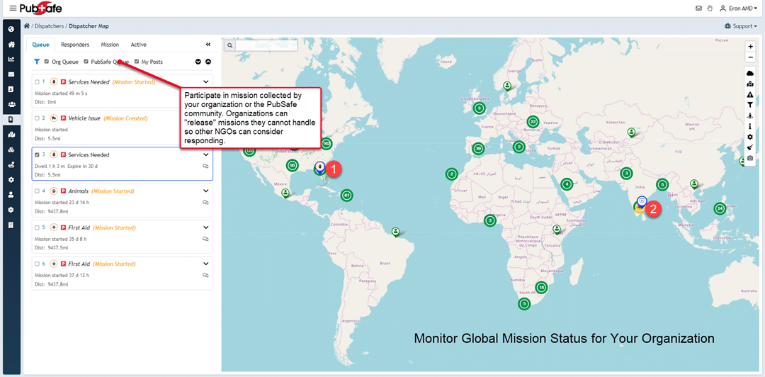
- Coordinate with NGOs and maintain disaster area awareness on PubSafe map
- Quickly message a single user or thousands of users for evacuation instructions
- Alert users of impending tornado, flash flood or active shooter
- See users location for efficient response to a help request when 911 is overwhelmed
- Create impromptu citizen search teams with tracking and messaging
- Track volunteer hours for funding
- Citizen Initial Damage Assessment orient efforts to hardest hit areas
- Real-time citizen feedback for decision makers
- Send messages to PubSafe mobile app users
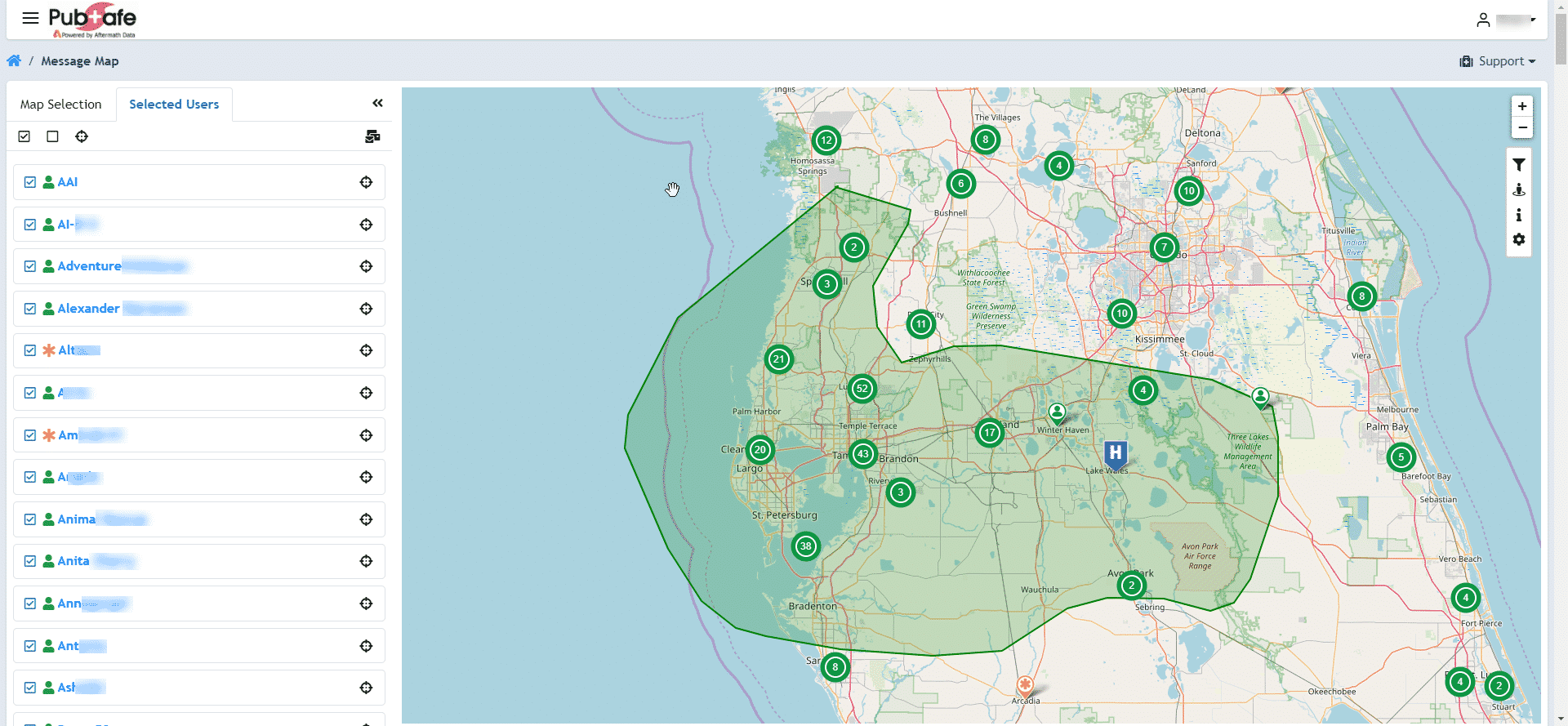
- Efficiently message a single user or thousands by clicking on the map
- Alert users of impending tornado, flash flood or active shooter
- See users location for efficient response to a help request
- No budget needed, funded by app users at $.99/yr
- Track search teams, chat and message members only
- Temporarily link volunteers for missing person search event
In today’s environment communication has built in inefficiencies resulting in information silos. Each agency or organization has their own communication channels which creates digital noise for citizens. Citizens cannot monitor Twitter, Facebook, County, NOAA, FEMA, Amber Alerts and other channels to get information. In the current environment 99% of users likely pick one and stick with it.
PubSafe provides a platform to bridge the gaps between agencies both nationally and internationally. Government users have the option of sending messages to people based on their location. Since PubSafe logs location information; alerts, notifications and messages can be geographically distributed through push notifications. FEMA and State agencies can study the movements of people just before and after a natural disaster to improve future communication and logistics.

Utilize Teams and Organizations
Agencies can register organizations and utilize almost all of the web portal features at no charge ($200 setup, $100 annually). Instead of charging hundreds of thousands of dollars like other companies, PubSafeTM distributes the cost to mobile app users. The fewer the users, the lower the investment by the individuals using the app. In general, messaging mobile app users, monitoring help requests, getting alerts and other features are part of this innovative approach to making the PubSafeTM platform very affordable to even small municipalities.
Investment
The first question is how can this data be free? The simple answer is that the citizens in the area crowd-fund the majority of the solution by paying $.99 annually for the mobile app. This model removes the barrier to entry for government agencies with funding limitations, long-lead procurement processes and multi-agency communication challenges.
Each agency accessing the PubSafeTM portal receives two years of free portal access. During this growth and implementation period, the agency has the opportunity to inform citizens of the PubSafeTM app. As citizens install the app, the installs count toward the minimum engagement goal. The minimum engagement goal is just 5% of the population as identified by the latest census for the area covered by the agency. If the agency is unable to reach the 5% goal, then an annual fee is due entering into year 3. The investment model is far less expensive than other alerting services but PubSafeTM has many additional features for total disaster management.
Mass Communication & Alerts
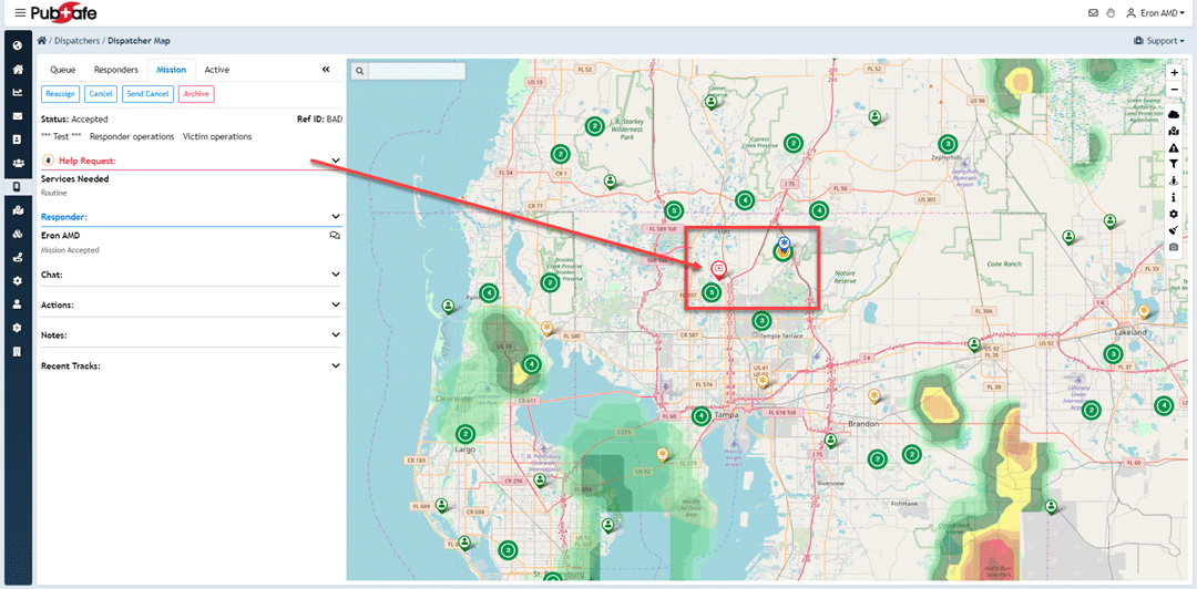
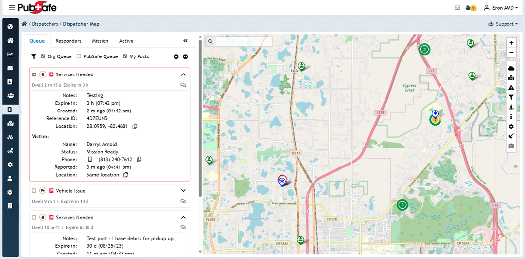
The PubSafeTM app is connected to the PubSafeTM management portal. In the portal PubSafeTM app users can be select from the map and send a message in about 8 seconds. The targeted geographic area must match the government agencies area of operation and be authorized to communicate public safety data (EOC personnel). The unique ability to target users in an area as small as home and as large as a state or region, give agencies a unique and cost effective method of communication never before available. FEMA can see where responders are located and citizens on the PubSafe mobile app.
Global Platform
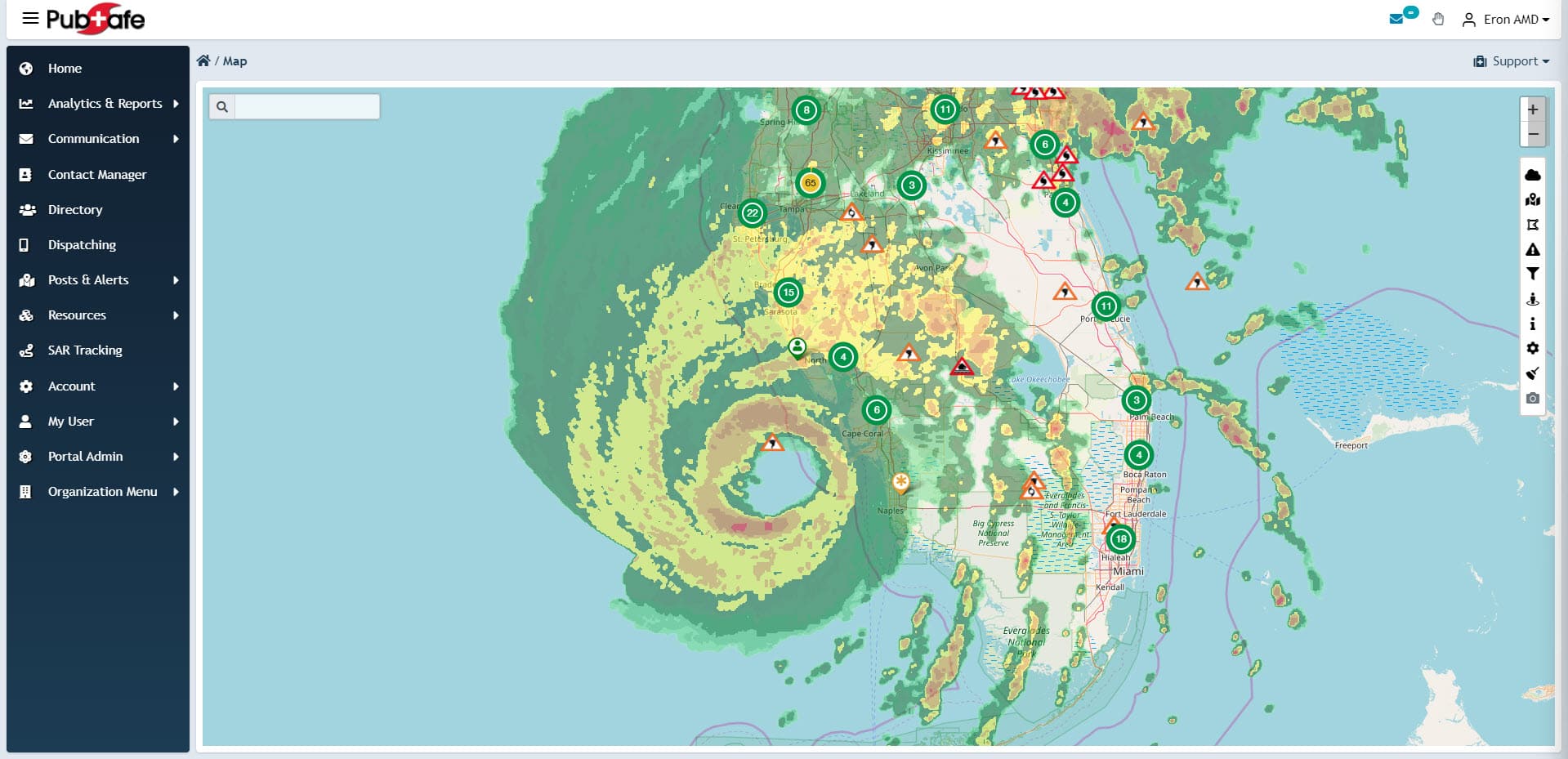
PubSafeTM can be used globally in areas with cellular data coverage (Internet access). Global access provides significant opportunities to assist partner nations during a disaster such as a tsunami or earthquake. PubSafeTM enables FEMA, NGOs and agencies to be more efficient in the delivery of the right support, at the right time, in the right location.
Active Shooter
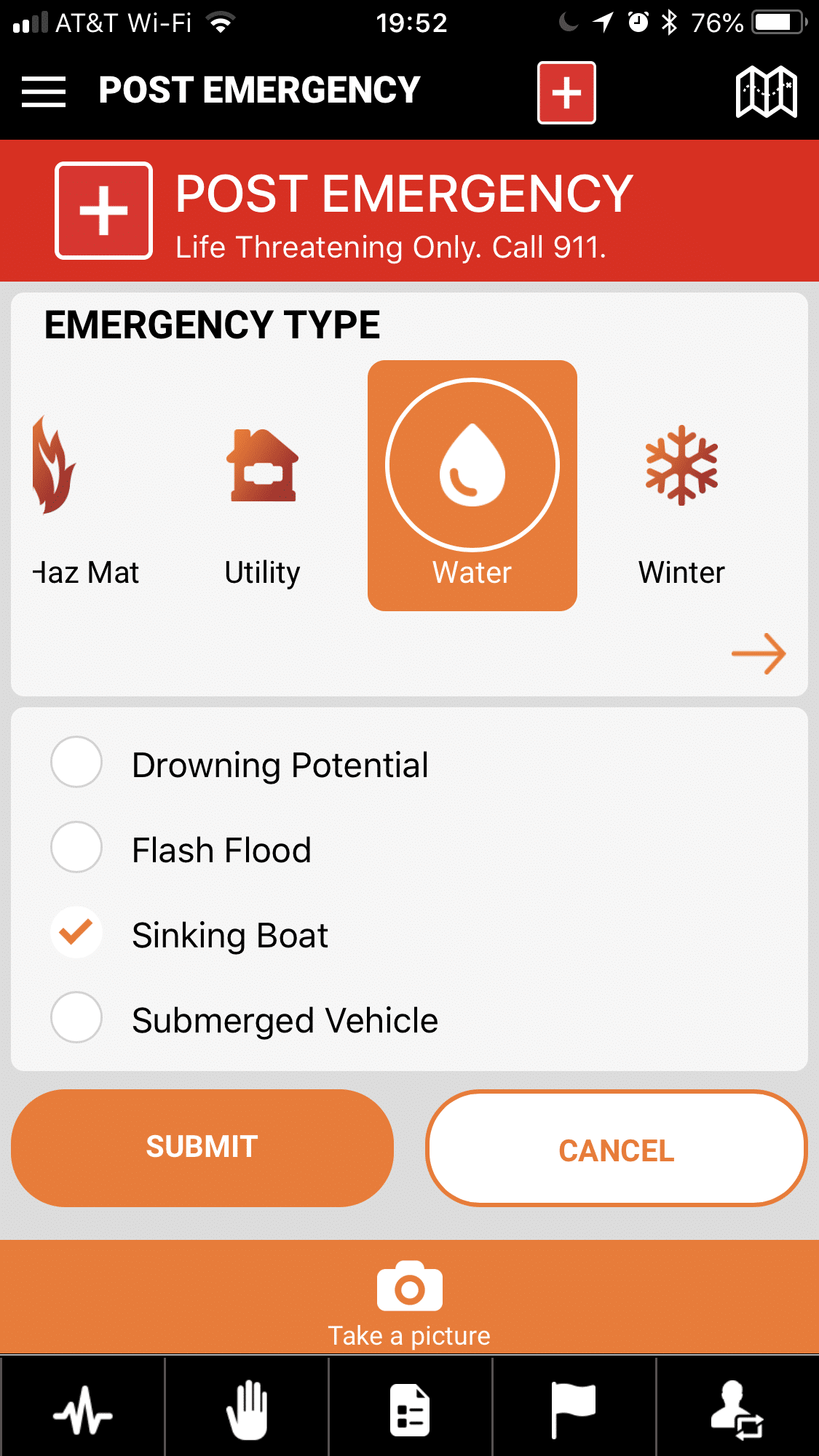
A challenge for many public and private organizations is how to communicate an active shooter scenario. There are many solutions ranging from complex audio sensor, to expensive text messaging services. PubSafeTM offers a viable, quick and easily adopted active shooter alert feature – free in PubSafe. When an active shooter alert is reported by any app user, PubSafeTM users in a 5 mile radius are automatically alerted in about 10 seconds! Users are automatically place into “invisible” status for their safety. The PubSafeTM active shooter solution does not take budget planning, training, fits into the lifestyle of smart phone users and can be implemented in schools, buildings, condominiums, sporting events and churches in minutes.
It is as easy as “We are going to use the PubSafe app for our active shooter warning system. Please download it to your smart phone.”
Always call 911 first!
Click Images to Enlarge


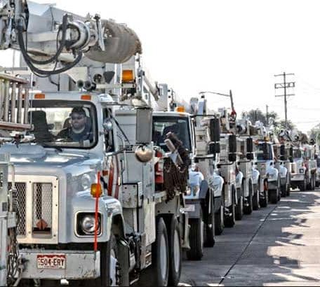
Hurrican Harvey
Hurricane Harvey was the real eye opener identifying the globes lack of preparedness to respond to a widespread disaster. It became evident there was a great need to improve communication between individual citizens, NGOs and government agencies. Volunteers responded quickly but had a lack of information that enabled them to use their initiative and enthusiasm to save lives. The Super Dome became a symbol of the chaos and highlighted the despair between social and ethnic groups. Hurricane Harvey was the inspiration for the PubSafe platform. If people in the Super Dome were simply able to post updates to PubSafe, public officials could have headed off the situation.
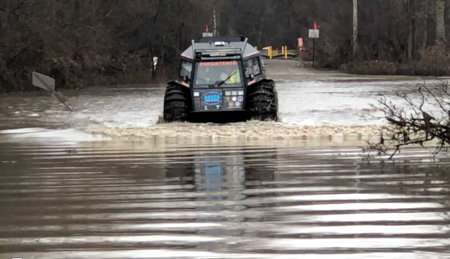
Hurricane Maria Case Study
In every disaster lessons are learned and processes changed. By traveling to Puerto Rico after Hurricane Maria, it became clear there were gaps in communication and information that would improve FEMAs response, international aid, local rescue and NGO on-going relief operations. With real-time information available down to an individual standing in a remote village, the response can be tailored in real-time to reduce waste and inefficiency. If PubSafe was in wide use during Hurricane Maria, FEMA would have seen what supplies was needed and where it was needed. Barges and personnel could have been assigned more efficiently with less confusion on the ground. Ongoing update using SitReps or Location updates, keep the information “fresh” and pertinent to a developing disaster. Heat mapping help and emergency requests in real-time enables the concentration of resources until an area stabilizes.
Real-time information also helps to ensure equitable distribution of resources. It is important to ensure all demographic groups (rich, poor, black, white, rural urban) are serviced equitably. Knowing where the help is needed helps EOC managers and FEMA ensure vehicles, shipments, food, water and other resources are not influenced by local politics, poor coordination or simple criminal activity.
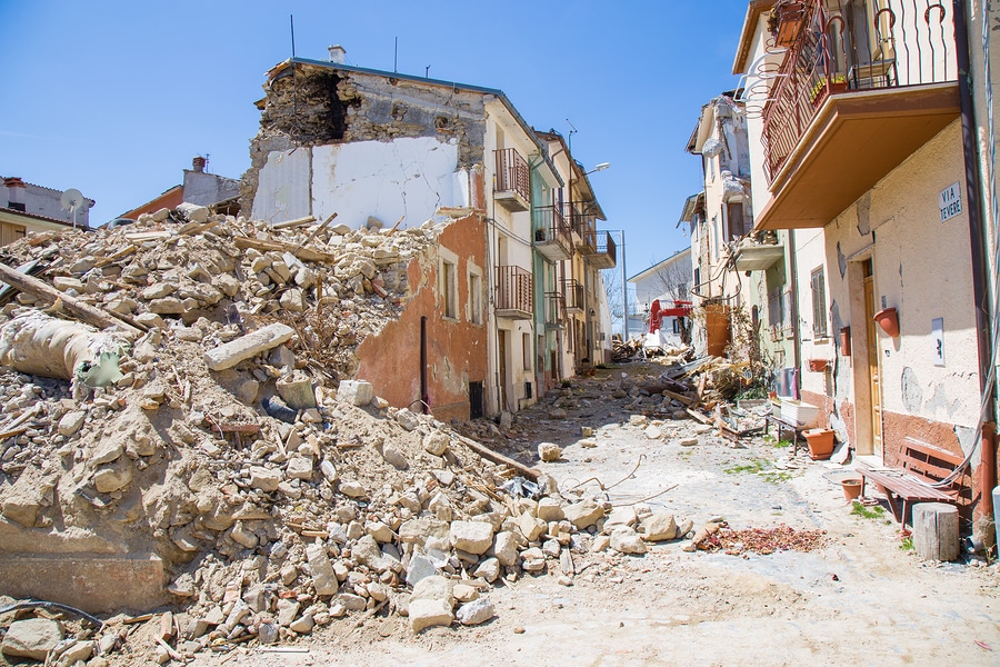
California Wildfires
PubSafeTM is probably better suited for wildfire safety alerts better than an other type of alert system. The alerts to the app are near instant and the laser targeting of one home to a neighborhood gives officials the ability to warn people directly in the path of a fast moving fire without alerting other two streets over. PubSafeTM can assist in the rescue of people and animals before, during and after a wildfire. Connecting people for months after a disaster is over enables support from around the world to be very specific to individual needs. Help might be needed for size 9 girl sneakers, removing a tree from a roof or transporting livestock to a safer location.
Tsunami Indonesia
With virtually no time to respond from a tsunami, a platform like PubSafeTM is essential to widescale and immediate communication. A direct line of communication from the government to every citizen removes delays in decision making. If the government cannot respond fast enough, citizens can alert others buy posting an emergency or help request. By default visible users are alerted within a 25 mile radius for help requests and a 5 mile radius for an emergency.
Emergency Management Continuum
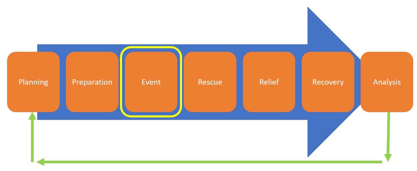
Utilizing Data
Planning
There are enormous opportunities for utilizing historical data to plan a more accurate, timely and efficient response. Over multiple events in an area, the data set will grow and gain significant value. The data collection process is not something that will happen in 1 or 5 years. Data collection from crowdsourced methods is a lifetime project. With PubSafeTM the number of citizens sharing data can be in the millions if local government communicates to use the PubSafeTM app.
Excellent data can:
Improve resource purchasing and staging
More accurate quantities of key resources such as generators
Assignment of areas of operation based on historical data and types of issues
Realistic training scenarios based on historical events
Preparation
When there is the luxury of being able to prepare for an event, being able to collect real-time progress data can significantly enhance preparation. Consider the local home stores being able to update stock on storm shutters or heating oil, grocery stores being able to report water and food availability, or nursing homes being able to request assistance moving elderly residents.
Resources come from around the country can all go onto the PubSafeTM app regardless of other GPS tracking services. By utilizing the PubSafeTM app, it instantly unifies the location data to a single map, platform and API feed.
Event
During an event, the goal is survival for those in the field. This may mean surviving a tsunami, forest fire, mass casualty event or hurricane. People in need will start to update SitReps and request help. The number, location and type of help needed will be available to the EOC for improved decision making. This enables decision-makers to adjust plans up to the last minute and keep making adjustments as the situation clarifies. It also reduces the amount of instruction and guidance well-trained responders need before entering an area of operation. Once onsite, responders have the needed information to prioritize their actions and resources.
Shelter & Aid Station Status
Reporting the status of shelters, hospitals or aid stations prevents people from going places that have no resources before, during or after an event. Live updates enable people to determine which alternate resource should be utilized, which is closest and if the right resources as available such as first aid or pet facilities.
RESCUE
The aftermath is viewed as the first 7 days after an event. During this time communication is fractured and people are at their most vulnerable. People are coming out of the rubble and starting to seek the basics of survival – food, water, and shelter. Knowing what roads are open, areas are flooded or blocked by fire is all imperative to efficient resource allocation.
During massive events, resources are lost, stolen or just abandoned due to inefficiency. There are millions of dollars in equipment and supplies that simply disappear. it is not realistic to have zero loss but improving 10-30% means tens of millions of dollars delivered to those that need it.
Recovery - Aftermath
After people recover from the shock of surviving an event and understand they can access food, water, and shelter, the recovery begins. At this point corporate America arrives, government resources are moving and people are helping people. People return to their homes and go to work putting their lives back together. It is critical to embrace corporate America and the resources they provide. Insurance claim stations, hot food from local churches and home construction supplies are all part of recovery and rebuilding. This phase starts about 5-7 days after an event and may continue for weeks, months or years as seen in the US Virgin Islands or Puerto Rico.
Analysis
Between events, emergency personnel work to review lessons learned. With the quantity and type of data collected by PubSafeTM, there is a virtually endless analysis which can be done. Understanding what is being reported, the timeline, location, and quantity provide an extensive opportunity to analyze and plan for the future.
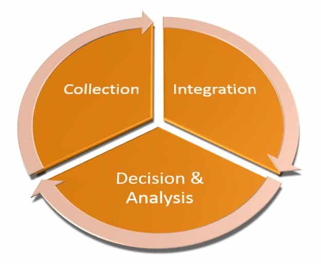
PubSafeTM Data Integration
PubSafeTM is not intended to be a replacement for the current system of data collection but to augment current processes. Since EOC technology and processes have been developed for many decades, organizations may want to export the data for utilization with existing maps or data sets. To facilitate enhanced data integration, APIs are available to provide anonymized data using industry standard data transfer protocols.
Contact PubSafeTM to discuss your data needs.
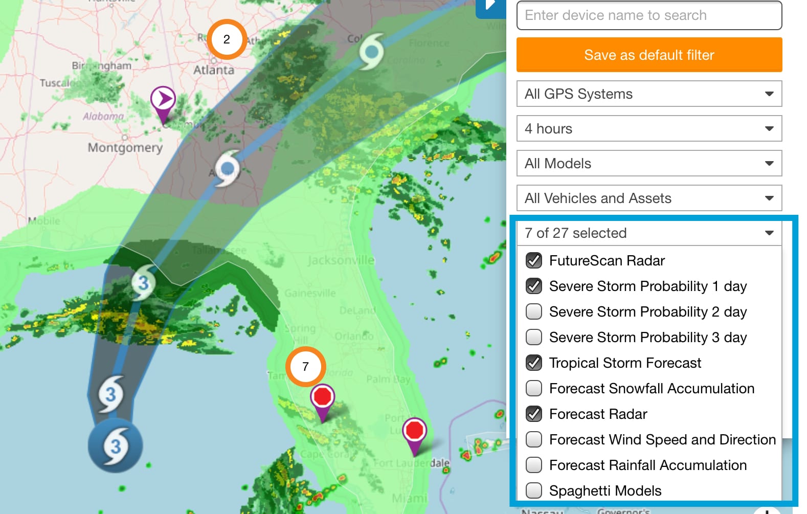
GPS Tracking Integration
Many government agencies utilize GPS vehicle tracking technology year round. Displaying this data on the map with the data being received improves situational awareness at all times. PubSafe is working with several GPS tracking technology providers to provide integrated vehicle tracking, asset tracking and equipment tracking with user data. Through APIs information can be shared to EOC maps and systems to increase the real-time information available..
If you utilized real-time vehicle tracking technology contact us to discuss integration needs. If you are interested in implementing a GPS tracking solutions we recommend www.fleetistics.com.