Avalanches are one of the most powerful and deadly forces in the mountains. Every year, they kill more than 150 people worldwide. In the U.S. alone, they claim an average of 27 lives—most of them backcountry users who ventured into avalanche terrain without being fully prepared. This is why making avalanche safety your top priority is so critical. Understanding the risks is the first step. The Ready.gov Avalanche Hazard Information Sheet is a fantastic resource outlining what to do before, during, and after an avalanche.
Thank you for reading this post, don't forget to install the free PubSafe mobile app and subscribe!
What Is an Avalanche?
An avalanche is a rapid flow of snow down a slope, often triggered by heavy snowfall, rapid temperature changes, wind loading, or the weight of a human crossing a slope. Avalanches can travel at speeds exceeding 200 mph and carry enough force to bury a person under 10 feet of snow in seconds. There are three main types:
- Slab avalanche: A cohesive plate of snow releases as a unit. This is the most deadly type and accounts for the majority of fatalities.
- Loose snow avalanche (point release): Starts at a single point and fans out. Less dangerous but can still knock people off their feet.
- Ice avalanche: Involves falling seracs near glaciers and high-altitude peaks.
The Dangers of Avalanche Snow
Avalanches aren’t just powerful; they’re also incredibly unpredictable. They usually happen on slopes steeper than 30 degrees, where gravity’s pull on the snowpack overcomes the snow’s ability to hold itself together. Several factors can make the snowpack even more unstable, such as heavy snowfall, quick temperature shifts, and wind loading, which deposits large amounts of snow in specific areas. It’s vital to learn the warning signs of unstable snow before you head into the backcountry. Keep an eye out for recent avalanches, listen for “whumping” sounds that signal the snowpack is settling beneath you, and watch for cracks forming in the snow. Recognizing these avalanche safety signs is a fundamental skill for anyone venturing into potential avalanche terrain.
Primary Causes of Avalanche Fatalities
Each winter in the United States, avalanches claim between 25 and 30 lives, with most of these tragedies involving backcountry skiers, snowboarders, and snowmobilers. The primary cause of death is asphyxiation after being buried under the snow. Survival is a race against time; the chance of being found alive drops dramatically after just 15 minutes. Most fatal avalanches share a few key ingredients: a weak layer within the snowpack, a slope steep enough to slide, and a trigger—which, tragically, is often the victim or someone in their group. Understanding these avalanche basics is the first step in making smart decisions. Proper preparation and constant awareness of conditions are not just suggestions; they are essential practices that can save your life and the lives of those around you.
Are You at Risk for an Avalanche?
The people most at risk are those who recreate in or near avalanche terrain: skiers, snowboarders, snowshoers, snowmobilers, backcountry hikers, and mountaineers. However, communities in mountainous areas may also face avalanche risk from natural events.
Understanding Avalanche Triggers and Slopes
Avalanches don’t happen by chance; specific factors create the perfect storm for a slide. The most critical element is the slope’s steepness. According to the Colorado Avalanche Information Center, “avalanches are possible on slopes steeper than 30 degrees.” To give you some context, many advanced black diamond ski runs fall into this category. Weather is the other major player. Most avalanches happen during or right after a big snowstorm, strong winds that pile snow onto certain slopes, or a rapid warm-up in temperature. Recognizing these environmental triggers is your first line of defense when deciding if a particular area is safe to enter.
Key Conditions for an Avalanche
While terrain and weather set the stage, the human element is often the final piece of the puzzle. The National Weather Service states that in a staggering “90% of avalanche accidents, the person caught in the avalanche or someone with them caused it.” This statistic underscores how much your choices matter in the backcountry. The main condition to look for is an unstable snowpack on a slope steeper than 30 degrees. This instability can be difficult to spot, but if you see signs like recent slides or cracks forming under your weight, it’s a clear signal to turn around. You can also help keep your community safe by reporting the hazard, which allows local safety teams and other recreationalists to be aware of the danger.
Warning Signs of Unstable Snow
Learning to read the snow is a crucial skill for anyone heading into snowy, mountainous terrain. Nature often gives clear warnings before a slope fails. Keep your eyes and ears open for red flags like recent avalanche activity on similar slopes, cracks shooting out from your skis or boots, or a hollow feeling underfoot. One of the most definitive signs is a “whumping” sound, which is the sound of a weak layer in the snowpack collapsing beneath you. Seeing these observations shared by others on a community platform, like the PubSafe public map, can provide life-saving awareness before you even leave the trailhead.
Your Avalanche Safety Checklist: Before You Go
- Check the avalanche forecast. The U.S. Avalanche Center and regional centers issue daily avalanche danger ratings from Low (1) to Extreme (5). Never enter backcountry terrain rated High or Extreme without expert avalanche training.
- Carry the right gear. Every member of a backcountry group should carry an avalanche transceiver (beacon), a probe, and a snow shovel. This gear is mandatory — not optional.
- Take an avalanche safety course. AIARE and the American Avalanche Association offer Level 1 and Level 2 courses for recreational users and professionals.
- Travel with a partner. Never enter avalanche terrain alone. Survival rates drop dramatically after 15 minutes of burial.
- Understand terrain features. Avalanches most commonly release on slopes between 30 and 45 degrees. Learn to identify avalanche paths and runout zones.
Essential Safety Gear and Best Practices
Venturing into the backcountry requires more than just skill; it demands a commitment to safety, starting with your gear. The three non-negotiable items for anyone traveling in avalanche terrain are a transceiver (beacon), a probe, and a shovel. Think of these not as individual tools but as a single life-saving system. Having them packed away is useless if you don’t know how to use them efficiently under extreme stress. Regular practice with your partners is just as important as carrying the gear itself. Your group’s safety plan should also include a clear communication strategy, detailing how you’ll check in and who to contact in an emergency. For organized response teams, platforms that allow for real-time incident reporting can be a critical part of this broader safety net, connecting your field team to a larger support network.
The Importance of an Avalanche Beacon
An avalanche beacon is your electronic lifeline. When you head out, everyone in your group switches their beacon to “send” mode, which transmits a signal. If an avalanche buries someone, the rest of the group switches their beacons to “search” mode to home in on the victim’s signal. This is where time becomes the most critical factor. According to rescue experts, survival rates plummet dramatically after just 15 minutes of burial. Without a beacon, rescuers are left searching blindly, a task that is nearly impossible in a massive field of debris. Your beacon is what makes a timely rescue possible, but only if you and your partners have practiced using it until the process is second nature.
Why You Should Wear a Helmet
While a beacon helps your partners find you, a helmet helps you survive the event itself. The initial force of an avalanche is violent, and it can easily slam you into trees, rocks, and other hidden obstacles. A helmet is your first line of defense to protect your head from traumatic injury during the slide. Beyond impact protection, a helmet can also play a crucial role if you are buried. It can help create a small air pocket around your face as the snow settles and hardens like concrete. This small space can provide you with the precious air you need to breathe while you wait for rescue. It’s a simple piece of gear that addresses two of the biggest threats in an avalanche scenario.
Safe Travel Techniques in Avalanche Terrain
Once you’re in the backcountry, your safety depends on every decision you make. Having the right gear is the first step, but knowing how to move through the terrain is what keeps you out of trouble. Safe travel is an active process of observation, evaluation, and choosing the path of least resistance—and least risk. It means constantly asking questions: What’s the slope angle here? What’s above me? Where are the safe spots? Think of your group as a small, efficient team where communication and a shared plan are your greatest assets. This mindset is crucial, whether you’re with a few friends or part of a larger coordinated effort where team management is key.
Choosing Safer Routes
The simplest way to avoid an avalanche is to not be where it wants to go. Avalanches are triggered on steep slopes, typically between 30 and 45 degrees, and they deposit their debris in the flatter areas below. Your goal is to identify and avoid these zones. The best options are often found by sticking to mountain ridges, traveling through dense forests where trees can anchor the snowpack, or staying on low-angle slopes under 25 degrees. However, it’s critical to remember that a low-angle slope isn’t safe if it’s situated beneath a steeper, loaded slope. Always look up and assess the entire path. The Colorado Avalanche Information Center emphasizes that understanding where avalanches start and end is key to staying out of their way.
How to Cross a Potentially Dangerous Slope
Sometimes, crossing a potentially hazardous slope is unavoidable. When this happens, you must minimize your group’s exposure. The golden rule is to cross one person at a time while the rest of the group watches from a safe location—a spot that is out of the potential slide path. This ensures that if a slide is triggered, there are rescuers ready to act immediately. Before anyone moves, establish clear communication and identify the next safe zone on the other side. If you’re on skis or a snowboard, you should cross high on the slope and maintain your speed. This strategy can help you use your momentum to ride off the slab if it does fracture.
Why You Should Avoid Cornices
Cornices are the beautiful, overhanging lips of snow that form on the downwind side of ridges and peaks. They are also incredibly dangerous and should be given a wide berth. A cornice’s fracture line can be much farther back from the edge than you can see, meaning you could be standing on a massive, unsupported block of snow and ice without even realizing it. Walking near the edge of a cornice is like playing Russian roulette with an entire mountain. They can break off from the weight of a single person or collapse spontaneously. Never walk up to the edge of a drop-off to look over without first confirming you are on solid ground. The safest approach is to stay far back from the edge, on terrain you know is fully supported.
What to Do if You’re Caught in an Avalanche
- Try to escape to the side of the avalanche flow if you have time and space
- Ditch your poles and skis if possible
- Fight to stay on the surface by swimming motions as the snow moves
- As the snow slows, cover your face with your arms and try to create an air pocket
- Stay calm to conserve air; spit to determine which way is down if disoriented
Immediate Actions to Increase Survival
If you find yourself caught in an avalanche, your immediate actions can make all the difference. The moment the snow starts to move, try to escape to the side, out of the main flow. If you’re on skis or carrying poles, get rid of them so they don’t drag you down or cause injury. Your primary goal is to fight to stay on the surface. Use a swimming motion, like a backstroke or freestyle, to keep your head above the churning snow. As the avalanche begins to slow down, bring your hands up to your face and create an air pocket around your mouth and nose. This small space is your lifeline. Once buried, it’s easy to become disoriented, so if you can, spit. Gravity will show you which way is down, helping you conserve energy if you try to dig.
As the Snow Settles
Once the snow stops moving, the clock starts ticking. Survival chances plummet after just 15 minutes of being buried, primarily due to asphyxiation. This is why traveling with a partner and having the right rescue gear is non-negotiable. Your beacon leads rescuers to your location, but a swift, organized response is what saves lives. This is where having a plan and the right tools for communication becomes critical. Effective volunteer coordination, whether among your immediate group or with nearby teams, can drastically reduce search times. Platforms that connect citizens, CERT teams, and public safety in real-time ensure that everyone involved in the rescue effort is on the same page, deploying resources where they are needed most.
What to Do After an Avalanche Burial
If buried, activate your avalanche transceiver to signal mode. Try to move your hand toward the surface. Rescue must happen within minutes — survival drops from 90% in the first 15 minutes to under 30% by 45 minutes. For the rescuer: dig at an angle from below the burial point, not straight down.
Initiating a Rescue: First Steps
Once you’ve confirmed a burial, the clock is ticking. Your group’s first move is to switch all transceivers to search mode and assign a leader to coordinate the effort. Begin a systematic search, moving quickly but carefully across the debris field. Once you get a signal, use your transceiver to narrow the location, then use your probe in a spiral pattern to pinpoint the victim’s exact position. When you get a positive strike, leave the probe in place. The most effective way to dig is from below the burial point at an angle, not straight down, to move snow more efficiently and reduce the risk of collapsing the air pocket. Remember, survival rates plummet after just 15 minutes, so every second counts. If you have a way to communicate with outside help, reporting an incident can mobilize a larger, more organized response.
Post-Rescue Care: Treating Hypothermia
Excavating the victim is just the first part of the rescue. The next immediate threat is hypothermia, which occurs when body temperature drops to dangerous levels (below 95°F is an emergency). Look for signs like intense shivering, confusion, slurred speech, memory loss, and drowsiness. Your goal is to get them warm and dry as quickly as possible. Move them to a sheltered spot, carefully remove all wet clothing, and wrap them in dry layers or warm blankets. Focus on warming the core of the body first—the chest, neck, head, and groin. You can use warm water bottles or your own body heat to help. Handle them gently, as jarring movements can be dangerous. While you provide immediate care, the next step is planning their evacuation, which requires seamless volunteer coordination with professional rescue services.
How Avalanches Affect Entire Communities
Some communities in mountain states face direct avalanche threat. Highway departments use controlled blasting to trigger small avalanches. If your community is in an avalanche zone, Ready.gov recommends signing up for local emergency alert systems and participating in community avalanche risk meetings held by local emergency management agencies.
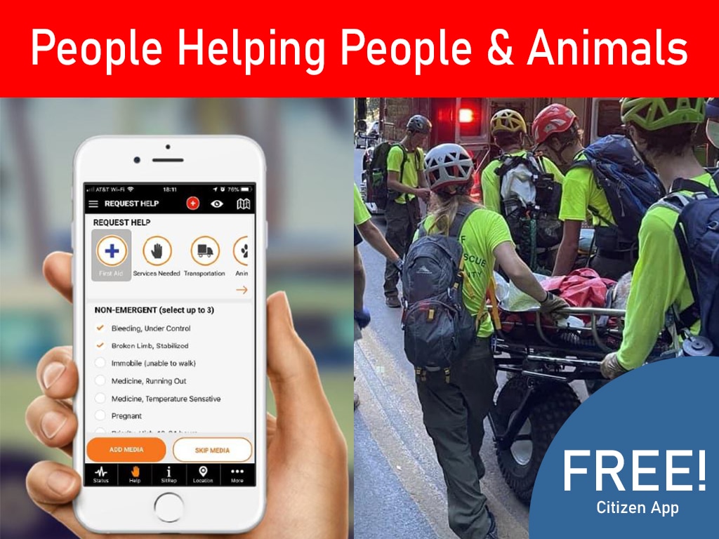
Using PubSafe for Better Avalanche Safety
When an avalanche strikes, situational awareness is everything. PubSafe enables real-time location sharing and emergency networking that can make a critical difference. With PubSafe, backcountry groups can share GPS location data so that in the event of a burial, rescuers know precisely where the victim was last seen. Community members can alert emergency networks instantly when an avalanche has been observed. PubSafe also allows users to signal that they are safe after a hazard event — reducing search-and-rescue burden and allowing emergency managers to concentrate resources where truly needed.
Your Go-To Avalanche Safety Resources
- Ready.gov Avalanche page
- American Avalanche Association: avalanche.org
- U.S. Avalanche Centers: avalanche.org/avalanche-centers
Download the Ready.gov Avalanche Hazard Information Sheet and connect your group through PubSafe — because in avalanche terrain, a connected team is a safer team.
How to Read Avalanche Forecasts
The United States has one of the world’s most comprehensive avalanche warning systems. The National Avalanche Center coordinates a network of regional avalanche centers that produce daily avalanche forecasts for key mountain regions, including the Colorado Avalanche Information Center (CAIC), the Northwest Avalanche Center (NWAC), the Sierra Avalanche Center (SAC), the Gallatin National Forest Avalanche Center (GNFAC), and many others. These forecasts use a standardized five-level danger scale: Low (1), Moderate (2), Considerable (3), High (4), and Extreme (5). Each level is paired with specific travel recommendations and hazard descriptions.
Most avalanche centers also provide detailed avalanche problem descriptions that go beyond the overall danger rating. Understanding “avalanche problems” — such as persistent weak layers, wind slabs, wet avalanches, or storm slabs — helps experienced backcountry travelers make more nuanced terrain decisions. Ready.gov recommends checking the forecast not just on the day of travel, but over the preceding several days, as recent snow history significantly influences current avalanche conditions.
Avalanche.org provides a consolidated national interface where users can access forecasts from all U.S. avalanche centers. The site also provides educational resources on reading forecasts, understanding avalanche terrain, and making go/no-go decisions for backcountry travel. The free FATMAP and Caltopo apps, widely used by backcountry travelers, integrate avalanche forecast data with detailed topographic maps to help users identify terrain that matches the current hazard level.
When Are Avalanches Most Common?
Timing is everything when it comes to avalanche safety. Most avalanches happen during or right after specific weather events, so knowing what to look for is key. Pay close attention to conditions during and immediately following a big snowstorm, periods of strong wind, or a sudden warm-up where temperatures rise quickly. These events create instability in the snowpack. While avalanches can happen on any snowy, steep hill, the vast majority—about 90%—start on slopes between 30 and 45 degrees. The causes of an avalanche can be natural, like new snow, or human-caused, which is why understanding the conditions before you go is so important for staying safe.
The Latest in Avalanche Safety Gear
In addition to the essential beacon-probe-shovel kit, avalanche airbag packs have emerged as a valuable additional safety tool for backcountry travelers. These specially designed backpacks contain inflatable airbags that, when deployed, significantly increase the user’s effective volume, helping them remain near the surface of an avalanche through the “inverse granular segregation” effect (large objects tend to migrate toward the surface in granular flows). Studies suggest that avalanche airbags reduce burial rates by 50% or more in scenarios where they are successfully deployed.
Avalanche airbags are not a substitute for the fundamental beacon-probe-shovel kit and the training to use it effectively — they are a supplement. They do not help if the user is already buried before deployment, if the user is caught in a terrain trap where the consequences of any burial are fatal, or in pyroclastic-style powder avalanche scenarios. Users should research the specific trigger system (mechanical vs. electronic) and maintenance requirements before purchasing.
Machine learning and satellite-based remote sensing are also beginning to transform avalanche forecasting. Researchers are developing systems that can identify unstable snowpack signatures from satellite data and feed them into predictive models that supplement traditional field observations. While these technologies are not yet widely deployed operationally, they represent the frontier of avalanche warning science.
Using Your Avalanche Beacon Correctly
Simply carrying an avalanche beacon isn’t enough; you need to be an expert in using it. This small device is your lifeline, constantly transmitting your location so you can be found, and it’s also your primary tool for locating a buried partner. Before you even think about stepping onto a snowy slope, you and your entire group should be able to switch your beacons from transmit to search mode and back again with your eyes closed. Practice searching for a buried beacon in a controlled environment until it becomes second nature. In a real rescue, you won’t have time to consult a manual. Everyone in your party must carry a beacon and, just as importantly, know how to use it effectively under pressure. Your partner’s life could depend on your speed and proficiency.
Avoiding Electronic Interference
One of the most overlooked aspects of beacon use is electronic interference. Your cell phone, smartwatch, GPS device, camera, and even some heated gloves can disrupt the signal your beacon sends and receives. This can make it significantly harder for rescuers to pinpoint your location or for you to find a buried victim. To prevent this, follow a simple rule: keep all other electronics at least 20 centimeters (about 8 inches) away from your beacon when it’s in transmit mode. When you switch your beacon to search mode, that distance needs to increase to at least 50 centimeters (about 20 inches). It’s a small habit to build, but it’s one that ensures your most critical piece of safety equipment will perform flawlessly when it matters most.
How to Get Involved in Local Avalanche Safety
Beyond individual preparedness, community-level avalanche safety programs play an important role in protecting mountain communities and highway corridors. Many mountain states maintain dedicated avalanche mitigation programs that use explosive charges, artillery, and helicopter-deployed explosives to trigger controlled avalanches on high-risk slopes before natural releases can threaten highways, railways, utilities, and buildings. Colorado Department of Transportation’s avalanche mitigation program on U.S. Highway 6 through Glenwood Canyon is one example of a large-scale, sophisticated avalanche management operation.
Residents of mountain communities can connect with their local emergency management agencies to learn about avalanche hazard maps, warning systems, and community emergency plans. Many mountain communities have volunteer avalanche rescue teams — consider joining one if you have the backcountry skills and interest. And connect your mountain neighborhood on PubSafe to ensure that when an avalanche event occurs, your community has the communication infrastructure to respond effectively.
Frequently Asked Questions
I have a beacon, probe, and shovel. Am I ready for the backcountry? Owning the essential gear is a fantastic first step, but it’s only one piece of the safety puzzle. Think of it like having a well-stocked first-aid kit; it’s not very helpful if you don’t know how to properly use what’s inside. The most important thing you can do is take a formal avalanche safety course and practice regularly with your partners. Your ability to use those tools quickly and effectively under extreme stress is what truly prepares you for the backcountry.
Do I really need to worry about avalanches if I stick to flatter trails? That’s a great question, and the answer is yes, you still need to be aware. Avalanches that start on steep slopes high above you can travel a long way, running out onto what seems like safe, flat terrain in valley floors. It’s crucial to not only assess the steepness of the ground you’re on but also to look up and identify any potential avalanche paths that could affect your route from above. True situational awareness means understanding the entire landscape around you.
What’s the difference between avalanche terrain at a ski resort versus the backcountry? The simplest answer is control. Within the boundaries of an operational ski resort, a professional ski patrol team actively works to reduce avalanche danger. They use explosives and other techniques to test and stabilize the snowpack, making the slopes safer for the public. The backcountry, however, is a completely uncontrolled, wild environment. Once you pass that resort boundary rope, you are entirely responsible for your own risk assessment, decision-making, and potential rescue.
Besides checking the forecast, what’s the most important safety habit to build? Without a doubt, it’s developing open and constant communication with your partners. Before you even leave the car, you should all agree on your plan for the day, your turnaround times, and what you’ll do if conditions change or something goes wrong. While you’re out, talk constantly about what you’re seeing and feeling. A group that communicates well makes better decisions together, and that shared awareness is one of your most powerful safety tools.
How does a platform like PubSafe fit into my personal avalanche safety plan? PubSafe acts as a digital safety net that connects your immediate group to a wider network. For your personal team, it allows you to share your location in real-time, which is invaluable information for rescuers if an emergency happens. On a community level, it gives you a way to report hazards you observe, like recent slides or unstable snow, which helps keep other people in the area informed and safe. It helps bridge the communication gap between your small group and the broader safety community.
Key Takeaways
- Safety starts before you step on snow: Always check the avalanche forecast before you go, carry the essential rescue gear (beacon, probe, and shovel), and invest in professional training to understand the risks.
- Travel smart in avalanche terrain: Constantly assess your surroundings for red flags like recent slides or cracking snow, choose conservative routes on low-angle slopes, and minimize your group’s exposure by crossing risky areas one at a time.
- Your rescue skills are a lifeline: In an avalanche, time is everything, so know the immediate actions to take if you’re caught and regularly practice with your partners to ensure you can locate and dig out a buried person quickly.
Related Articles
- Avalanche Rescue App: Real-Time Safety & Alerts | PubSafe
- Enhance Avalanche Rescue With PubSafe Mobile App
- Winter Outdoor Emergency Preparedness For Skiing, Avalanches & Winter Storms
- Winter Outdoor Emergency Preparedness Guide for Skiers | PubSafe
- Safety Plan Tips for Travel & Adventure | Free Guide – PubSafe