Empowering NGOs & Communities with Real-Time Safety Solutions

NGOs & People Helping People & Animals. Connecting people and resources to improve public safety and disaster response. 

What is PubSafe?

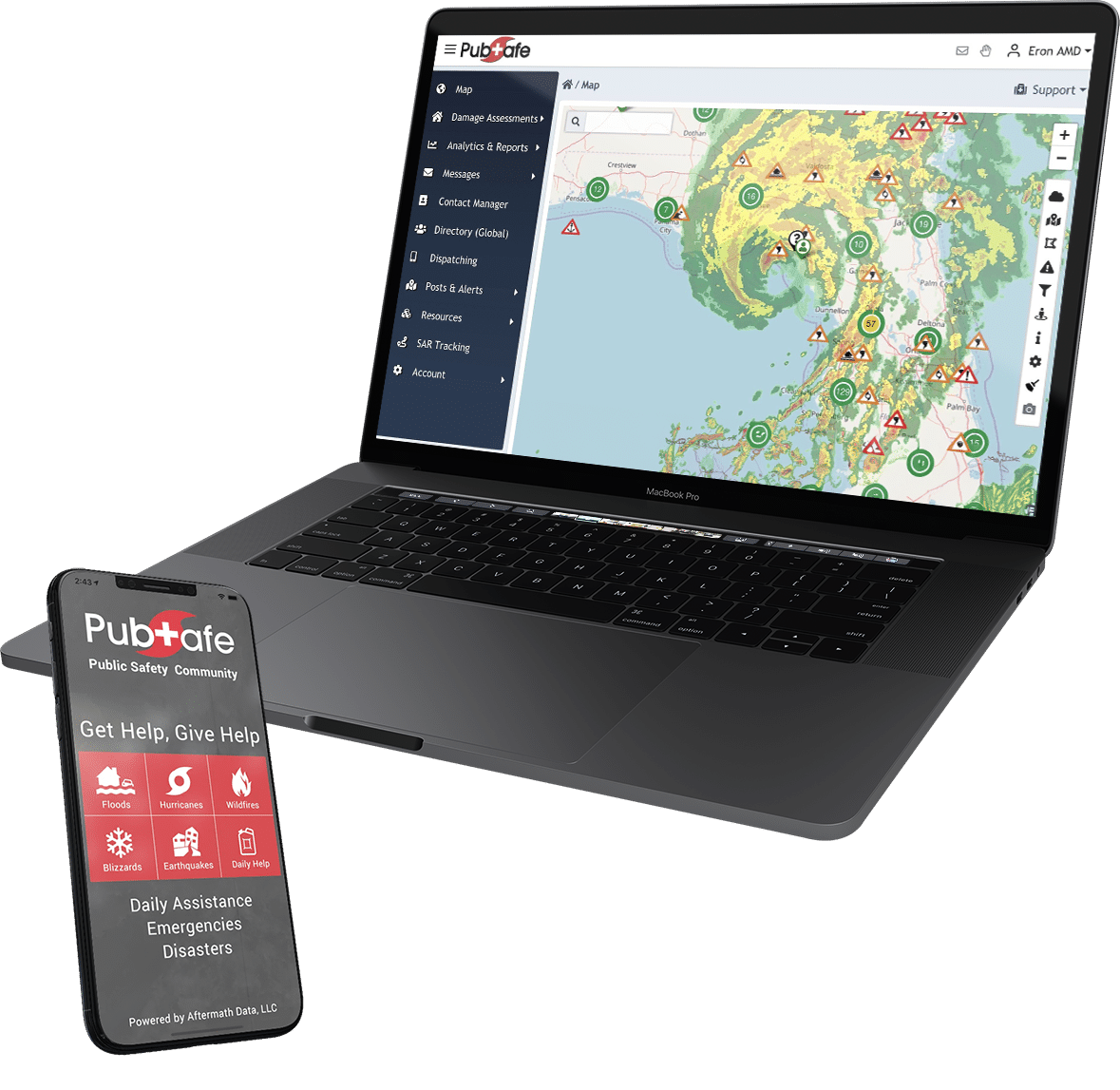
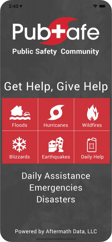
The PubSafe mobile app is a comprehensive citizen safety network designed to connect communities, organizations, and citizens for real-time information sharing and coordination.

The web portal is for NGOs, FBOs, CERTs, and government agencies to monitor information  in real-time. NGOs can manage their organization, dispatch, communicate and coordinate with other organizations or agencies globally.

PubSafe’s mission is to build safer communities by providing the tools necessary for effective communication and a swift civilian & NGO response during emergencies.

Create free organization account

Schedule Portal Tour


Why PubSafe?

Purpose Built

PubSafe was built from years of research and input from many NGOs and individuals who have responded to disasters. It enables volunteers with initiative and improves efficiency during blue and gray skies.

Schedule a web demo and give it a try. Online accounts are free, pay just $5 for the Pro app. Cancel at anytime. No annual payments or long-term contracts.

Free Active Shooter Alert System

How PubSafe Can Empower Your Organization

Citizen Reporting

Every citizen shares data on local events providing real-time information for the community and responders.

Interactive Map

Stay informed with our live map displaying real-time incidents and resources in your area.

Resource Coordination

Efficiently manage and allocate resources during emergencies.

Organizations

Organizations can see who needs help, where and the resources needed, in real-time.

Incident Reporting

Easily report incidents and share vital information with your community.

Community Alerts

Receive and send alerts to keep everyone informed and safe.

Solutions

As a registered organization, you gain access to our online portal; equipping your team with a myriad of features designed to help your team operate with increased safety and efficiency by connecting them in the field and allowing headquarters to effectively co-ordinate them from base.

For Communities

Empower residents to contribute to community safety

For Organizations

Enhance organizational response and resource management.

For Emergency Responders

Provide first responders with the tools they need for effective operations.

App Screenshots

Our app is designed for responders in the field; connecting them with their organization’s home base through the portal, facilitating collaboration with fellow responders, and allowing them to respond to alerts, accept missions and have their status and location tracked for safety and effective co-ordination.

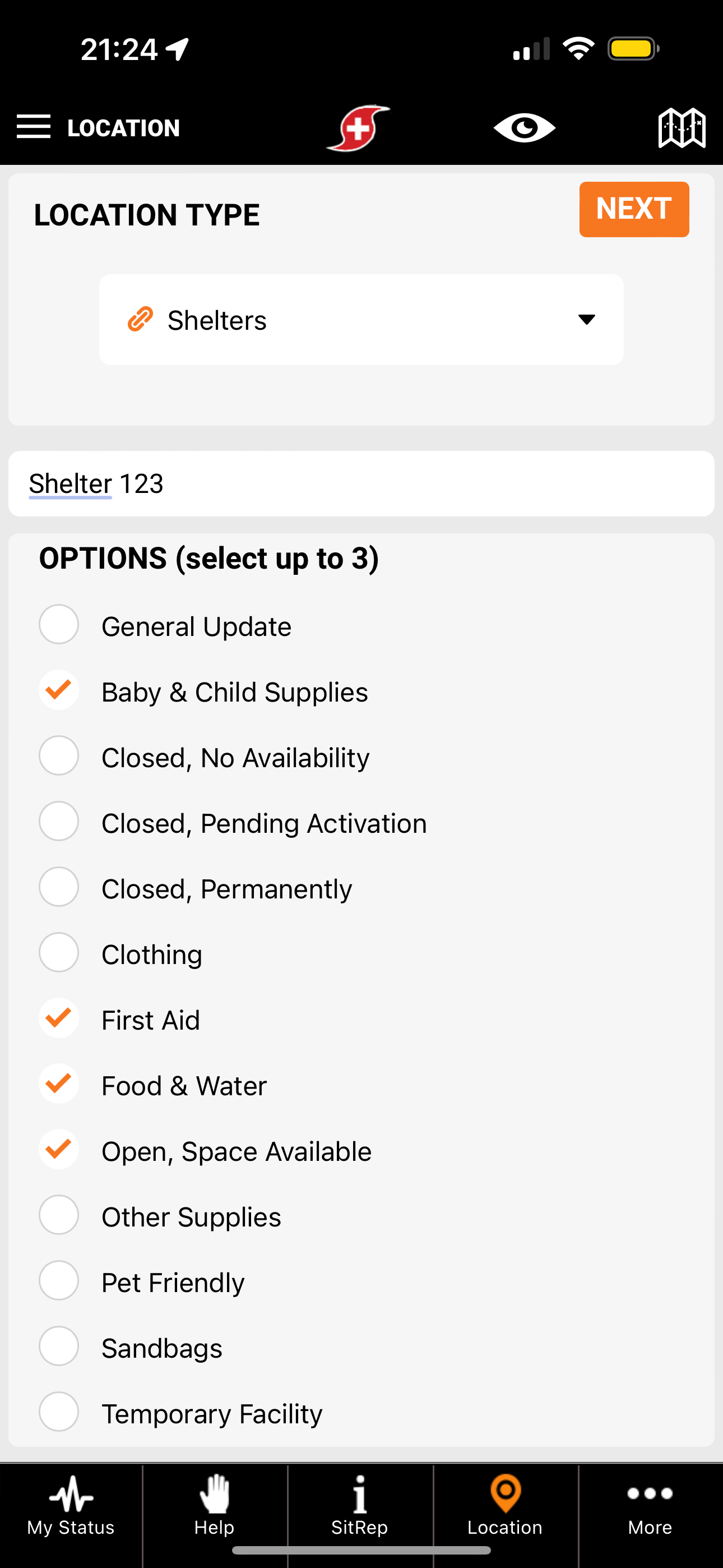
Location Update
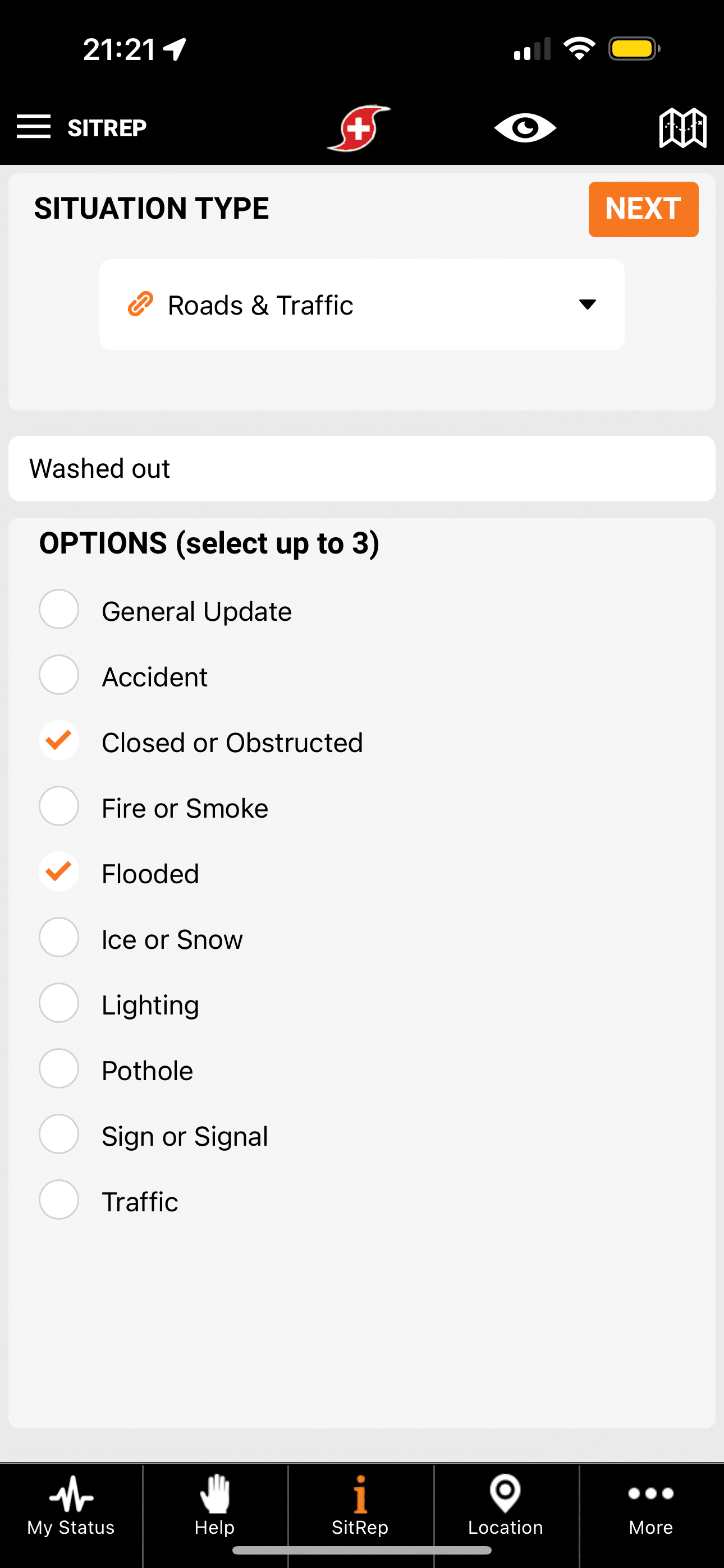
Situation Report from Hurricane
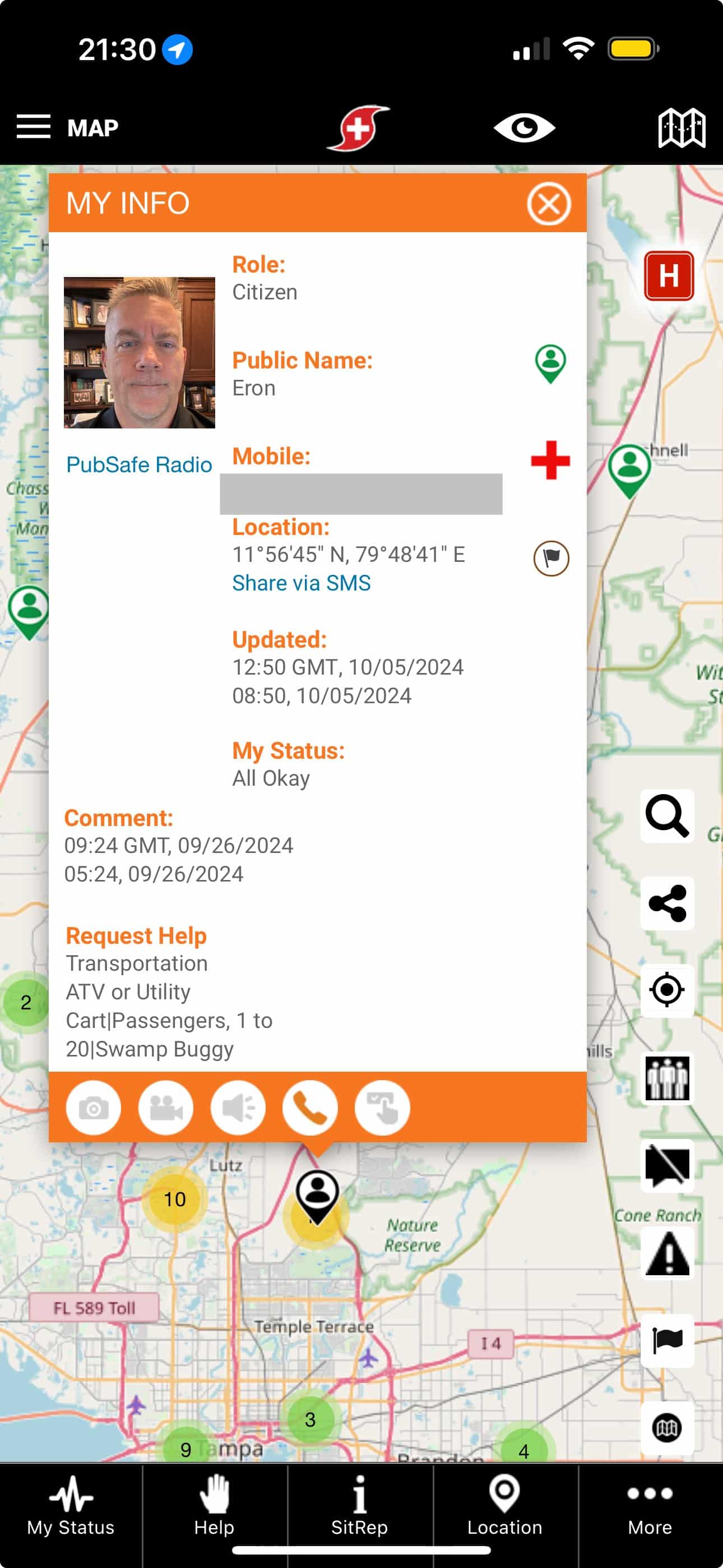
PubSafe Member Info Window

Platform Presentation

So, you’re interested in doing a deep-dive & learning more!

In the following video, PubSafe founder Eron Iler gives a full presentation of the platform that will give you a clear idea of PubSafe’s mission, its features and how PubSafe can empower your organization.

View how the PubSafe platform was built from the ground up to enable organizations to operate more efficiently resulting in more lives and property saved. The mobile app and web portal provide critical tracking and dispatching capabilities to help request missions in the area from citizens in need. Onboard volunteers in minutes without using Excel or typing in their information. Conduct digital Damage Assessments which are automatically uploaded to your web account. View weather radar in near your teams to keep them safe. With PubSafe you can operate globally in cellular coverage to locate and help keep your teams safe.

Video Transcript
Click Here to Open

So, PubSafe in its Essence is about helping people and animals trying to connect people to help one another through kindness and initiative but
also, engaging with NGOs government cert teams FBOs and bringing everybody into the fold so, we can all be on the same sheet of music we can share information, and we can coordinate among the different groups to work to get the best outcome. I want to pose a couple questions to you think about this as you think about the challenges in your experiences that you’ve encountered over the years.

What if you could have multiple NGOs inserts seeing sharing and communicating information about a disaster from a single platform?

What efficiencies would that provide what if you knew the exact location of a victim either for a foot Helo or boat rescue as well as knowing the location of all your people what if you could take in more data and help requests than a 9-1-1 Center could during a disaster?

Now, what if you could alert a single person or potentially thousands of people in a second or a few seconds that were about to be hit by a tornado overrun by a wildfire or a flash flood?

Think about campers in a campground being warned of a flash flood that’s coming or people just living their daily lives, you know tornadoes coming in the middle of the night. What if organizations could be joined together for a short period of time to be in a unified environment to improve the response effort?

So, not only the NGOs and the certs but we could bring in the government we could bring in entities you know government agencies, utility companies, really anybody from outside the area or even local assets and resources that wouldn’t normally be part of the process could join into a centralized platform where the EOC, the NGOs, the organizations would be able to see the pieces of the puzzle moving around on the chessboard and be able to work effectively with one another and really improve that overall efficiency.

You know our goal is to reduce the barriers in the information silos and improve that efficiency in the speed of decision making. We want fast decisions, but we want decisions based on good real-time data. This process of collecting data to make a decision is a challenging one, you know in situations where a regional disaster takes place you know the current methodology is getting better.

I mean there’s drone surveying but there’s only so, many drones in the air, right? You have public officials that are going out and doing surveys but think about the power of having every citizen out there being able to push information to a centralized platform where the EOC and the NGOs could look at that, and they could very clearly see where the hot spots are the types of requests that are coming and they can see pictures of houses and trees and things like that to really get a real clear understanding of the level of disaster in a particular area and then they can start to allocate those resources effectively.

And whether you’re a civilian, and we believe every civilian is the potential to be a data node if they want to contribute to the data set, or a volunteer who you know you may be volunteering with the Red Cross or VORAD or in an organization like that and this is your first experience you can be out there collecting information doing sit reps to share that information. Or you could be with an experienced organization like an NGO or a faith-based organization or the government who has a very structured process in dealing with disasters.

PubSafe Works to bring all of those entities together and get that information shared across the normal lines of communication that sometimes are very slow that require a lot of red tape to make things happen as opposed to…

Let’s log in and take a look and see what’s going on just a little bit of a backstory to kind of let you guys know where I came from. I started PubSafe you know I was a marine infantry officer where they taught us to shoot move and communicate and do that as quickly as we could. And if we were able to do that then we would outperform our enemies, and you know be successful in the battlefield. In a disaster it’s very much the same thing.

We’ve got the four C’s, and we want to cycle through those four C’s as quickly and efficiently as possible. I do have a technology background. I’ve been in technology for 22 years, GPS tracking and telematics primarily. Also, doing software development which has really given me the confidence and the ability to go forward and quickly evaluate you know what I’ve seen, starting with hurricane Harvey and the Cajun Navy at that time sitting on the side of the road and trying to determine how do we solve the problem of that many people wanting to help full of initiative they’ve got assets and capabilities at scale that the government doesn’t have.

The problem is overwhelming. How do we facilitate taking advantage of what they want to offer, right and in that process, you know I decided that the mobile app was the only way to you know really to start that process. So, PubSafe in its first version was an app to app solution you know, simply hey tell me what I need or you know let me post what I need, and then let other people see that. Let’s alert people in that area that actually have a viable chance of responding and let those people with that initiative reach out to those people and go solve those problems no instructions on how to solve or you know is the problem too difficult or too dangerous.

You know that is for people to decide. Our opinion is that we do not manage the one percent. We manage the 99% of the positive outcomes in any organization whether it be a government response or an NGO or a volunteer response there’s going to be one percent that something goes awry, and it’s unfortunate that’s the way it can be. So, we want to stay focused on all the good that can be accomplished through training through initiative through information sharing. I have been to multiple hurricane zones to help but mostly to watch and listen and understand and talk to people and get to know what the challenges are for organizations that are responding, and then try to build those solutions into the technology that we’re providing.

And the last part is that we decided that we really had to assist the NGOs in their journey in the disaster management space. NGOs have become such a critical part of this whole process that we wanted to make them more efficient we wanted to remove the barriers that you know were repeated over and over again. And the two most common things that that you know that I ran into that just you know provide inefficiency is not knowing which team members they have in a particular area. You know, no tracking capability, so, it’s constantly calling people trying to say hey where are you or you know what road are you on or how far are you from you know those types of things. So, we wanted to handle the tracking piece.

And then everybody’s using online spreadsheets to track what everybody calls cases. We call them missions you know with that military mindset. You know tracking them on spreadsheets, well those Google Docs only last for so, long and then somebody leaves. A different disaster takes place. You lose contact information. You lose the historical information, perspective from you know online spreadsheets that are being shared and we wanted to move that all to a web portal and make it all available at a very cost effective price to let people and encourage people to move to the web where we can do so, much more for them so, they can do more for others.

The goal for today is simply education and awareness you know. We want people to be aware of the PubSafe platform. We want NGOs to know and understand the power of the platform to encourage people who you know take advantage of the 90-day free evaluation and at the end of this we’re going to talk about pricing. I’m just going to flat out tell you what it costs so, you know. Stay tuned through this and we’ll get there. We want you to install the free mobile app and there’s no requirement to go beyond the free mobile app.

So, you should get the free mobile app and hope that you never need it first of all, but secondly if you get it you’ll get a chance to experience what the average citizen will see and experience and how they can use it. And how we collect information and what information we do collect, right? And then lastly, hopefully, we’ll be able to get feedback and ideas from you that says hey if you do this a little bit differently this would really improve the value proposition. Or hey, I didn’t see this. Have you guys thought about adding something of this nature to this because this type of thing would really help us out?

That actually happened within the last couple months. I was at the BOAD conference, and the topic of disaster assessments came up and I realized that the platform didn’t have the, you know disaster assessments, damage assessment, so, you know we got on it right away we created a damage assessment form.

And now what happens is when someone fills that form out from an organization, they enter their mobile app credentials. Those credentials are associated with an organization if they’re part of an organization, and those damage assessments then upload into the web portal where the organization can see the damage assessments that are being done. But also, those damaged assessments are shared with every other you know PubSafe organization if they so, choose to share, and that way the entire environment responding to disaster is becoming more situationally aware.

That’s just an example of how we got good information and we quickly within I would say within two weeks you know we had this thing fleshed out and working inside of the platform.

All right. So, who is the mobile application good for and who should be thinking about it? First of all, every citizen in this country, actually in the world should be on the PubSafe platform, and that’s really our goal is we want a single unified Public Safety platform where people can go for alerts, shared information, to request help, to get help locally as they travel and move around the world. Things of that nature. Anybody that’s going outdoors, fishing, hunting, boating, biking, backpacking, any place that you’re going to be within cell service should have the PubSafe mobile app.

I tell people all the time, install the app and hope that you never need it, right. But every day when you watch the national news think about this. Just tonight or the next day or two someone’s going to get lost, a boat’s going to sink, someone’s going to get injured, and you know cars veer off the road, people get stuck in their cars for five days at a time and nobody knows where they are, right.

If you have the PubSafe mobile app, it gives responders an opportunity to have a starting place. Your last known location can be shared if you so, choose, and family and friends know where to go. And it’s free right, free it doesn’t cost anything to have that little level of insurance in your back pocket.

Certainly, NGOs inserts, we want to encourage them to use both the web portal and the mobile app. You know as an organization, when you get to interacting with the web portal (and there is a small fee for it and I’ll talk about that) but it’ll help you manage organization, helps you communicate share information, and coordinate across organizations right.

So, if you have two NGOs, three NGOs, 20 NGOs working a single disaster, we have the tools that allow sharing information between those organizations. So, if I can’t handle something because I’m a swift water rescue specialist you know I’ve got somebody else that is a canine search NGO specialist. Let’s get the right help requests to the right people and all those organizations can use the tools that we provide to collect up those help requests, bring them into the PubSafe environment and then either work it themselves or push it out to make it available to others to work.

That’s one of the ways that we are really working to break down those information silos between organizations. And that can happen between the government and the NGOs and the FBOs and the certs as well. It doesn’t, it’s just not NGO. It’s every organization in PubSafe, right.

Next is you know anybody that you know may be responding with different types of rescue elements so, if you know that there’s going to be a big flood you can see in the picture on the left you know you’ve got a boat that’s searching around through a neighborhood. You know we saw it with hurricane Harvey. People standing on their rooftops or in their attics, stuck in their attics trying to get assistance and there wasn’t a technology available at the time to direct people, responders directly to the people that needed the help.

When you think about helicopter flight time and the cost of that at ten thousand dollars an hour right, it is super important that the helicopter be able to fly directly to a victim, effect to rescue, and come
straight back. Sometimes they’re flying out at a distance where every drop of fuel counts. The time on station is super important, therefore they need to go straight to the victim and not have to look around to find the victim. They can actually just take the mobile app and fly straight to them, fly straight to the house. The other thing is if they’re flying straight to and from victims back to rally points, they’re able to do more rescues. You know you’re more effective, you’re more efficient, you’re doing more for more people.

In the top right we have location updates. Anybody that has a location whether it be a home goods store, a food bank, a, you know a hospital in PubSafe, if you can update that location information and share with the community your status. So, if your hospital has no beds, you don’t want people coming to you when they could have gone the other direction and gone to a hospital that has plenty of beds and it was only two minutes farther, but now they’ve wasted time coming to a hospital that has no room and you’ve got to turn them away.

If you have a food distribution point that is going to be set up from ten to two you don’t want people showing up at nine or five and missing that. You want to show your hours, the food that you’re going to be serving and the location that you’re going to be serving it so people can come to you directly. You can be efficient and serve as many people as possible.

Another point of using the mobile app is the ability to communicate. You can message people globally within an organization. You know organizations can message members and that member could be a single individual or you can actually go onto our map and you could draw a circle around the entire globe and every one of your members could potentially be messaged that way.

The other thing we do with communication is once somebody posts something to the platform we actually alert people in the area so, if somebody says hey I need some assistance you know I’ve got a flat tire I’m not sure how to change a flat tire or I’ve got a driveway full of snow and I’m not able to shovel snow because I’m too old or I’ve got a bad back then that alert goes out to people in the area and hopefully somebody’s going to do the neighborly thing and come over and provide some assistance.

Certainly, if it’s a more life-threatening situation, let’s say for example a hunter falls out of a tree stand and is hanging in the tree, that hunter has to try to communicate to 9-1-1 where the hunters located, and that may be in the woods on the back 40 acres right. Well, the nearest help might be the deer hunter that’s on the next property that he doesn’t know who that person is, but if they’re both sharing the PubSafe app and he posts the help requests, that other Hunter is going to get notified if he’s within the within the radius, and that person would then see the location on the map and be able to come over and help him directly.

Here in Tampa, we have people that sink their boats all the time. It’s a common occurrence. You know that 99% of the time the nearest rescue is the next boater over because there’s so many boaters in the area. Things that nature. You can also use a laser focused messaging approach or mass messaging approach to the general public if you are a government agency.

In the mobile app, there’s four main sections. My status, sit rep, location, and assistance requests. And we break assistance requests down into routine and priority. At this point I will say that we are not connected to 9-1-1 or Emergency Services. If they choose to monitor it, more power to them. We certainly encourage them to do so. It is not a replacement for 9-1-1. We hope that PubSafe can become a data source that augments the existing systems and information that they use, but it is not monitored so, you always want to call 9-1-1 or your emergency service first if you have a life and death situation.

You can share your location with other members or an organization. You can be in a citizen or a responder status, and what that really means is as a responder you can receive a mission assignment and there are requirements for that. You’ve got to upgrade the app you’ve got to be connected to an organization et cetera et cetera but what you are in essence saying is I have a capability, and I’m willing to help as a responder. As a citizen I’m here, this is my location, if something happens at least you’ll have an idea of where I am. If you so choose, you can go completely invisible. We have a slide on privacy, and we’ll talk about that in just a minute. You have the ability to switch between organizations or teams.

This is hugely unique in this space. What this means is you can join two, three four different organizations and as you move and operate you can switch between those organizations and communicate and share with the active organization or the team. That’s a very viable thing because a lot of us volunteer for more than a single organization and we’ve got to be able to operate in between those organizations. And the price doesn’t change just because you’re a member of three organizations or one.

We offer Mission dispatching or case management as is often called. We applied logic to match skills and resources of the responders to the help request, and we make suggestions to the dispatchers so, they can effectively make the decision as to which responder they should dispatch to a help request faster and more accurately. We offer chat between mobile app users. We offer public announcements and organization-wide 6 messaging, and we track volunteer hours, which is a big deal you’re you know you’re trying to get money to get reimbursed for the efforts that are done. We have a tool for tracking volunteer hours, and I’ll show you that.

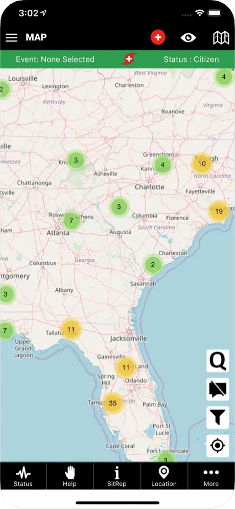
Let’s talk a little bit about location tracking. You can see on the map we have users that have shared their location. You can choose not to share your location at all, which is totally fine. If you want to leave your location on the map you can, you know you can leave your last known location on the map and then turn the phone off. And maybe that’s at a trailhead or something like that so, you want people to know hey I left from this point, but I need to save my battery as I’m hiking for three days you know.

Maybe you’re going boating or something of that nature. So, you’ve got all these different options with location sharing. The value of location sharing is the ability to get messaged and alerted based on where you are. If I’m in Tampa and I travel to California I don’t want to get alerts from Tampa. I want to get alerts from California. That’s where my risk is right. I may have moved into a wildfire zone in California not knowing it and I want to be alerted based on where I’m standing.

If I travel overseas and I need some help and I post up you know assistance request, the people overseas that are on the PubSafe platform are going to get alerted. So, if you get a flat tire in your riding a motorcycle around the world the motorcycle Community is going to respond to help you. So, the more people that we get on the free version of the PubSafe platform, the better the response is going to be for day-to-day situations. And that’s really our goal, a global Public Safety platform that it would be great if nobody ever needed it, but that’s not going to be the case.

And if you’re in a community in a rural area let’s say the Malawi flooding that was going on not too long ago you know PubSafe the free version of PubSafe could be used to you know post alerts to share information to share photos and things that nature so, not only can the people of Malawi see what’s going on, NGOs from around the world could look at the map in Malawi and they could see exactly what was transpiring so, they know where to plan to go and what resources are going to be needed in those areas.

Do I need a truckload of food, or do I need swift water rescue boats, right? Well because it’s Global in nature and you can you can look anywhere on the map and you can see what’s going on locally, PubSafe facilitates that process.

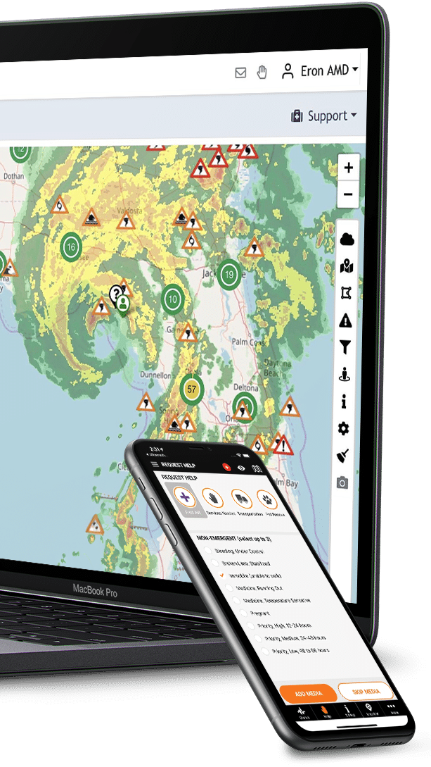
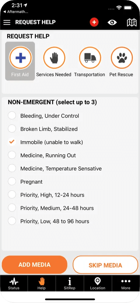
Here are just examples of the two types of help requests. We have a routine on the left and we have a priority on the right which is you know obviously driven by the red nature of that interface. Routine help requests, not life-threatening and not a substantial amount of property damage that’s going to be taking a place, you know you could have a broken limb, and it can still be okay, right? If you have a broken limb with a pulsing artery and a compound fracture you know then you’re obviously looking for something a quicker response through a priority emergency request.

Here in this example on the top left we have sit reps. Sit reps are great. It’s a military term for a situation report where you know you can do a sit rep on anything. And that includes nothing right. Hey there’s nothing going on in my area, well that tells the Incident Commander that you know I don’t need to send resources over there because I’m getting 20 reports from people in that neighborhood that tell me nothing is going on over there. I can probably believe that to be true. Over here I’ve got a hundred reports of people saying that there’s a big disaster situation, lots of life and property damage. That’s where I need to send my resources right. So, sit reps are great.

Number two on the upper right is location information. This is where hospitals and retail establishments and other places like that can you know post in real time what’s going on with them. You know if Home Depot is getting a load of generators at three o’clock on Wednesday because they’re out today, they can post that information and that way customers know to go there. If Lowe’s is getting a shipment of plywood you know use for boarding up windows and hurricanes you know Friday at 8 A.M then people can go there and we’re not wasting time driving to places that don’t have the resources, the beds, the food, the shelter, whatever those things are.

And the people that manage those locations can be constantly doing updates too. The community can look at this central point of information and know what’s going on. They don’t have to try to scour 15, 20, 50 different websites and social media to try to figure out what’s going on at a particular shelter.

We have offered teams. We’ve created the team capability where families can create a team. You know search and rescue teams can create a team. Any kind of group of people can get together and create teams. The process of inviting people is through a link and a QR code. You can just hold your phone up and you know scan the QR code.

We do that for most of the join functionality that we have which makes it very simple and quick. And then you can go in here and you can look at the different teams, join you know different teams. You can switch between those teams if you’re a member of two, three different teams just kind of depends on what version of the app you have to be able to work with teams.

All right so, next is the web portal and the web portal is my favorite part. We got a lot of great stuff in the web portal. We really went overboard in putting in functionality to help the dispatching process, the process of taking in a help request, understanding what it has to offer, where it is, and then getting it out to a responder in the area that can effectively you know handle that situation.

We have a robust map with real-time data so we built this robust mapping capability. 95% of the web portal interaction during its disaster is going to be through the web portal and we recognize that, so we wanted to put as much information in the web interface as possible to facilitate effective and efficient communication.

You can easily filter the map so you can see the different types of posts that are available. You can see current and future weather radar. You can toggle between organizations if you so choose. You can do messaging out to your organization members if you’re an NGO or a corporation.

If you’re the government, you can actually message all PubSafe users in your area of operation so, if you were a county and using this platform you could go in and you could message everybody in your county or you could message a neighborhood you know or a missing person search party something of that nature and you know take advantage of that capability because we push those messages to the mobile app.

We provide organization specific URLs so, instead of everybody trying to create a form or like a paper form (God forbid) or a digital form you know. What we said is we’re going to give you those forms and when those forms are completed the information that comes through those forms is going to automatically be inserted into your PubSafe portal account.

So, if you do a damage assessment, you’ll be able to see it in a menu in the web portal for damage assessments. If you if you publish a help request link on your website, you push it through social media, you email blast it or whatever the case is, when people fill out that help request those requests are going to come into the web portal in your organization’s help queue right so, we queue things up by organization. If you can’t handle it or don’t want to handle it, you can release it to the general cue and any organization in PubSafe would then be able to look at it, pick it up, claim it and then dispatch it to one of their field teams.

Then we also have volunteer registration. If you, if there’s a big disaster and you’re onboarding you know 500 volunteers at one time, we wanted to automate that process as much as possible. They fill out the form, boom it straight up into the web portal and then all you have to do is then go through and approve those volunteers to participate with the organization. So, it’s a temporary status until you approve to bind them to your organization.

We have the ability to do impromptu missing search parties. We have a contact manager to help NGOs and search manage their routine contact information, you know, who are the members, what are their phone numbers, emails, you know emergency contact info, some of those types of things. So, you’re not trying to manage it on a spreadsheet that you may or may not have access to. Hey, you just log into the portal and there you go.

The portal is also good for those training exercises where you can track your members as they move around. You know maybe do an orienteering or something like that because we can track the mobile app and they can choose to share their location to the mobile app then you know you can use that to build the situational awareness that you need, either in training or in real life. You can see that we do tracking, search party tracking. There’s two types of tracking. Your last known location right, and then we have track history like we’re seeing here.

We do limit the track history to 96 hours because that’s really as long as a search party would take effect over like a four-day period. It’s a privacy thing. Users can also turn off your access at any time. Users always have the ultimate control over their visibility. We have done an integration with the Geotab telematics platform so, we’re now looking at vehicles as well as mobile app users on the same map, and that gives us a an even better picture of you know do we have mobile assets you know vehicles, fleet, generators, fuel trucks, things like that in the right locations.

Where are they if they’re in route to our teams. You know, how do we help bring those two teams together so they can refuel the boats and things like that so, that’s an important integration and we’ll continue to do more telematics integrations as we are approached by others. You know there’s a couple big companies out there, Samsara Verizon connect you know some of those guys would be glad to do the integrations to show their data inside of our platform.

So, here’s an example of how you, one of the message methods that you can select users on the map. You can see you can get all kinds of crazy shapes. You just drag your mouse around. That automatically selects the users puts them into a list and if you are eligible to message those people, i.e. as an organization, you can only message your org members, it’ll tell you three of the 20 members or users selected are not part of the organization and they will be excluded from the message that actually goes out.

If you’re the government and you’re allowed to message to that particular area of operation you would be able to select everybody and message everybody that you selected. It brings up a little window you can set the priority for the for the messaging and you can select from a template. Templates are great because it standardizes communication and it makes it you know it makes it so you have fewer typos and things that nature. We do have capabilities to require two user approval right so, we don’t have any situations like in Hawaii where they thought they were under a missile attack because of a mistake.

You can see that you can chat any user around the world one to one if they allow that. The exciting part is if you are a global organization like the World Health Organization or UNICEF or something like that, you’ve got people operating in foreign countries around the world and you’ve got a question for them, or you want to say hey you’ve got bandits coming your way or reports of bandits in the area you could message them directly.

You don’t have to try to you know try them on their cell phone or something like that. You can just send them a message through this single pane of glass that you can have up in your global operations center, seeing all of your assets and people moving around the world. Since we’re collecting this data, we’re able to provide some dashboards and feedback. And think about this, this may not sound like a big deal but as an NGO you have to go out and raise money and to be able to show people that you are good stewards of their money.

You can take information like this, and you can say hey, look we’ve got one of the highest mission success rates that that’s out there. We’ve received 125 help requests, we were able to complete 90 of those help requests, we only abandoned five and the other ones were incomplete because they weren’t really help requests for whatever reason. That’s information that you can share with the public and your donors to show how good of a job you’re doing.

The other part of that is if you get 125 help requests and you only complete 20 as an organization you can look at that and figure out how you can get better right. So, it completes that feedback loop. If you’re using spreadsheets and trying to do that, you don’t truly know. We want to automate that process for you so you can do an honest self-evaluation, and you can decide how you can improve your overall contribution.

All right, member security and then we’re almost done with this so, member security. There’s just a wide variety of privacy options there. You can opt to participate in public benefit research which is you know this big picture of you know how many help requests and what types of help requests did we get, where did they come from, you know did we respond effectively to all the different socioeconomic areas of our community, did we put assets in the right area, do we did we see you know extensive flooding in one area versus another we need to maybe pre-position or treat a community differently based on the types of issues that they have.

Maybe we need to implement certain policies in certain areas that may be prone to flooding or wildfires or things of that nature right so, all that public benefit research is where we’re headed with the data that we’re collecting, which is why every citizen being a data node is such an important concept.

Every citizen though, or every user of the platform ultimately has the visibility options, and you’ll see as we look at the mobile app you can choose to share internally with all of the PubSafe users or with none of the users. You can share with your organization or with your team. You get to choose.

And the last slide is you know what’s the investment in this so, just to be completely transparent, the free version of the app obviously is free. You know you can’t interact with you know between the free version you can’t join an organization with the free version and be a member of an NGO that’s using the web portal. That’s not allowed. If you’re with an NGO assert type organization, you need to upgrade the mobile app for five dollars a month and that will allow you to be bound to an organization as a member right or to volunteer with an organization. You can cancel that subscription when you’re not using it.

That’s all done through the app marketplaces that’s not controlled by us you don’t you know we don’t have a credit card online payment form. You just go straight to the app stores, and you say you know enable my upgrade or disable my upgrade so, you might only use it for three months out of the year, one month out of the year, that’s up to you.

Our competition says hey it’s it may be a hundred and twenty dollars annualized and we’re going to bill you one year in advance for it. You know we are not driven by the fiduciary responsibility of the shareholders. We’re a public benefit corporation which means our focus is on public benefit as opposed to driving profits for shareholders, right.

That’s a big, big difference between us and a lot of other organizations so, you know five dollars is as low as we could possibly go and still do development hosting of all this information things that nature, and we wanted to take the budget issue away from the organizations. We didn’t want the government to have to go out and get a budget, we didn’t want NGOs to have to go out and raise tens of thousands of dollars to have a platform like this when we volunteer to do this type of thing. Five dollars a month per user is nothing you know we spend that much money in gas just getting to an event you know we’re putting a lot of our own money, and you know five dollars a month per person is the absolute minimum.

If you’re a government agency, then the price goes up a little bit because now we’re giving you a messaging capability. Normally our competition comes in and says hey we’re going to charge the county five hundred thousand dollars you know to be able to do this type of messaging, and that’s not including all the other capabilities that PubSafe brings to the table. Or like in the State of Florida the state buys the platform and gives it to the government agencies, you know the local governments.

Well, I can only imagine what that costs. It’s got to be in the millions if not tens of millions of dollars that the state is ponying up for a basic messaging capability and what we’re saying is we’re pushing that to just the users that are interested and connected to an organization so, it’s going to be far less expensive, and you can message everyday citizens that are out there at will anytime right.

And then we have Enterprise users which would be like a, you know a private corporation or a corporation or private business traveling the world, and they want to use the PubSafe platform for command and control tracking their people. To the organization the first year we charge 199 dollars and then every year after that it’s a $99 administrative fee, and we are offering a 90-day free trial so, you know you’ve got nothing to lose to register your organization.

You won’t be billed the $199 until after the 90-day period so, you gotta have to pay the five bucks to upgrade the PubSafe mobile app from the free version to the pro so, you can interact with the web portal. And you have to have the pro version even create the, you know to do the application for the organization but you’re looking at five bucks for a 90-day trial just to get in there and poke around. We have no service contracts. I mentioned that you know you pay through the app markets there’s, it’s monthly not a one-time annual.

So, that concludes the PowerPoint presentation. We’re going to take a quick break and we’re going to come back and we’re going to look at the
mobile app.

Okay so, here we are with the PubSafe mobile app which I am mirroring from my phone to my desktop so I can record it. I want to give you just a quick orientation to the app itself. On the top left-hand corner, we have the admin menu. As you see here, we have the four main functions down here which is my status, help request, sit rep, location updates.

Over here we have a more menu which leads to organizations alerts communication missions things of that nature.

We come up top and we have the eyeball icon here. That is where the user can change their visibility at any time. You can share with the pubsafe community, be invisible, or only share with an active team or organization. Remember you can toggle in between organizations and teams, and this is why it says active team or organization.

At the top we can see that we have a blue bar that indicates that I am in responder status. A responder is represented by the little star that you see here. Somebody that is in citizen status is represented by the silhouette. The color of the responder status indicates the mission status of that user, and I’m not going to click on a user, well you know I’ll click on my user.

There’s my information and this is what you see in the status window. And you can see I can click to call, I can chat, I can see the GPS location, I can see resources and skills, so, as a dispatcher I can try to, you know match that to the help request visually. If I need to, I’ve got a picture for reference if I’m going to be meeting with somebody and things of that nature.

Down here on the right we have a quick menu icon. We do offer the ability to log debris pick up for removal. You can mark roads that are closed, accident issues, gasoline available, things that nature. We really felt like debris pickup was such low hanging fruit that we wanted to include that just because we know somebody else does that, and we do so much more that we wanted to just say hey look we’ll include that. It’s just another function for us. Let’s get it in there and then you know enable the map to filter that.

And we have an option down here where we have different mapping options. We can filter the map by our team or the organization we can we can add user labels which will put a label on there so, as a dispatcher or someone looking for somebody in the area to see who’s in the area I would see the labels, or I could do a search for somebody by their username which would be their public name, things that nature. And on here is where I can change my role. I can go from responder to Citizen, and you’ll see now this bar is green indicating that I’m in a citizen status and I have not selected an event.

An event is where information is associated with a particular event and that event can actually be a public event like a FEMA designated event or it can be an event that I created for my organization which could be like a local missing person search, and I want to affiliate activities with that data. And over time we’re going to get better at providing feedback based on events.

I can go back in here and I can switch from my citizen role to responder role, and you’ll notice when I do that it brings up what my mission status is. If you’re in mission ready you can be assigned a mission. If you’re in any other status you cannot be assigned a mission. So, when a mission is complete, you mark it as mission complete. Mission not complete and then you become eligible to receive another mission. If you go back into mission ready status, if you’re on break, maybe you’re exhausted, you’ve been, you know you need 20 minutes to catch your breath or you need some sleep, then you’re going to go into off duty and that way dispatchers know your status.

Okay, and you can navigate around the map anywhere in the world and, you know users will pop up. You’ve got to be at a certain zoom level to see certain things so, that’s important, but let’s look at the four menus across the bottom real quick.

My status – this is to share information with family and friends, so they know what’s going on with you. Hey, I’m going to a shelter, you can type a comment in there and hit submit and that information posts up, so when they click on your icon (because they would be able to see your last known location) your status would be visible in there. You can go to a system; you know the help request icon down here at the bottom it brings up this you know, is it routine assistance or priority assistance.

We already talked about that but let’s look at the process. So, like I selected donations, right, then it says give me specific information about donations and what you need from those donations. And I can hit next, I can add pictures so, if this is a help request again, I’ve got a broken leg, I can take a picture of that broken leg and everybody’s going to understand clearly. I can skip that part, I can put a free form comment in here because sometimes you know you just have to be able to explain things a little bit further and this is where you can expire information, so if a road is closed or washed out and completely gone, or a bridge is gone, then you know maybe that’s going to be a post for 90 days. If it is a traffic jam it might be a three-hour post and that will automatically remove the information from the platform.

And then the final screen here is looking at who do you want to share that information with, right. This here, who do you want to share that with. You have the option of not alerting anybody (we use that a lot for testing). Down here you can see your location which you can then click on, so if you want to put that into an SMS message instead of trying to read that to somebody, you can text that to family and friends or you could use the built-in functionality. We again we do encourage you to call 9-1-1 first in an assistance or help request situation, but if you forgot we’re going to prompt you again here to make that call.

Sit reps – lots of options for different types of sit reps, right. Electricity, humanitarian, fuel, earthquake, blizzards, crime, all of these different types of things. Let me point out crime, in Android we actually have more crime options. We built this particular aspect because we want our state attorneys to be able to collect information on price gouging that you know, right now is being called into a call center. It’s not necessary to do that. You can save a lot of money.

Get, you know, get people on the PubSafe app they can go out and take a picture of the price of you know the fuel or the hotel or whatever, the receipt and they can say, Hey, you know this place is price gouging the price is 50% over what it normally is. Here’s a picture. That can all be gathered up in a data set that the state attorney’s office could then use and follow up on. That can happen thousands and thousands of times very, very quickly. It’s not something that requires someone to pick up a phone, yes, tell me about it. You know we’re using the GPS location off the phone. We’re getting pictures and we’re getting a good description of the type of crime that’s taking place.

Android, like I said, has more options. We’re trying to work with apple to allow us to bring a lot of that functioning function into apple or into iOS.

So, go back let’s go back up here… The other thing I want to point out is down here for SAR and NGO volunteers we’ve got a list here of different things specific to SART and NGOs, you know if you’re out doing a missing person search and you find some evidence you want to mark it, it’ll GPS it and put it on the map and then the investigators can come take a look at it.

They don’t have to, you know, wonder, wander around, waste time trying to find you, things of that nature. You can say, hey look, this is our rally point, you know let’s go ahead and assemble here things of that nature and you can push that information out. And the process is the same after this screen. You add media, you add a comment, you choose one to expire it and then who to share it with. And the last one is location so, if we chose hospital and first aid stations you can see all the options that are available here.

Okay, so here we are at the web portal. To access the web portal, you simply go over to the login. That’ll bring you to this screen. The credentials used here are those that you use in the pubsafe app. If you are trying to connect to an organization when you log in, you won’t be able to see the organization unless you have already upgraded to the pro version of the PubSafe app, so save yourself a minute get the free version, go to the admin menu in the top left hand corner, and do the upgrade there, and then come log in here.

We use the app credentials in a wide variety of places so, it’s something that you’ll need to be comfortable with. So, we’ll log in and this takes you to the map, since you know as we discussed the map is going to be the primary place where dispatchers and people operate. These are people around the globe that have chosen to continue to share their location. We’ll zoom in on the United States, oops, you can see the weather that is currently sweeping across the Southern United States getting some rain. You can see the responders and different status.

We have a variety of different map options over here, different weather types of weather that are available, different saved views for the map so dispatchers can jump between different map views. We can select users on the map so if we were concerned and wanted to message these people ahead of the storm, we could do just that and then hit that button and we would be able to message 22 users if we had access rights to do so. Again, as an organization I can only message organization members. I cannot message the general public. As a government agency, I can message any PubSafe user.

We can filter the different alerts that we get. These are all the iPods alerts, all of those are integrated into the platform. We can filter the map in a wide variety of different ways. We can filter the map down to only show us organization members, responders in a particular mission status, org posts only, et cetera, et cetera. My location… here’s a little map key explains some of the icons.

We can add and remove labels to the map. We can clear the map of all filters, and we can view any post that has media attached to it. I didn’t see any last time I was in here but if somebody had posted something with a photo then we’d be able to see just those, which is a, you don’t want to have to open up every post during a disaster to see which ones have media attached. You want to you know filter through all that.

Damage assessments – I don’t think we have any in the queue at this point but if someone was to, here’s some unverified damage assessments right. These show you where they are. These happen to be overseas. You can click on it brings up some basic information. All of them have a unique identifier.

You can claim the damage assessment and that allows you to move it to the next level. Once you claim it as an organization, what you’re saying is I’m going to go out and verify this and then you can switch it from being unverified because any citizen that is not part of an organization that submits a damage claim or damage assessment is flagged as unverified. The damage assessment form is a web page. It’s not inside the mobile app, so anybody that has the URL can get to it and access it. That URL is specific to your organization and the user can choose whether or not to share it just with your organization or make it available to the PubSafe community.

Okay and then so, if you’re gonna, this is really something that happens post-disaster. You’ve got a bunch of damage assessments and maybe you’ve got a trained team on doing your damage assessments. They would go out, inspect, and then either delete the current damage assessment and create a new one or call back to dispatch and say hey it’s accurate, put it through and it becomes part of a bigger data set.

This is the analytics reports we looked at the dashboard. This is where volunteer data that is captured from the mobile app appears here so you can see the hours and things of that nature that are coming together. I don’t think we have any data in this test account, nothing in the past 21 days, but you can filter that and imagine what that’s going to look like. We do keep a history of all the messaging that goes on, right, just for accountability. You can see who sent it and what the message was, date and status. It’s also, a way of looking to see if the system got the message out. Are you, you know, sometimes you wonder did it go or did it not go.

These are organization members. These are all internal to our group so, nothing confidential here. I could check a box and send them all a message, right. I could select from a template. I could put that together. I can allow responses, or I can say hey no, this is just a one-way message, it’s just FYI or I could say, Hey you can chat me back and facilitate that process.

Contact manager we discussed. This is really a big deal. I don’t know if people fully grasp that whole thing, but this is a big deal. Again, just test users in our account directory. This is actually a global directory of Emergency Management contacts could be anywhere in the world and locally you would want to go in and enter local information about you know if you’re going to be traveling to Malawi and you know that you’ve got NGOs coming in and you’ve entered your information, when they get to Malawi they can already start looking up contacts in that area so they don’t have to hunt around to find people.

Dispatching – this is probably the biggest function that you know we have to offer in the PubSafe portal. And dispatching is the process of collecting those help requests and then pushing those help requests out to responders. And it doesn’t, we don’t have any open help requests in our account at this time. If there were, they’d be here and then you’d be able to move over to the next stage.

We’ve got like there’s nothing in the queue. The ones that we have played with we’ve moved over to here and there’s my user and I’m mission ready. I can drop this down, and I can see details. I can call. I can message. I can you know I can chat. That all looks good. Then what I want to do is I want to, I would match that to a mission and assign or send this to, as a dispatcher send this out to this user and that user would get a message. They would say do I want to accept or reject, if I accept then it moves forward in the process right, and that’s how this whole thing works.

And then you ultimately end up over here and you can see as a dispatcher you know the different stages of these events. You can look things up by their mission reference ID. You know all these different filters that we have pending acceptance, different responders, things of that nature so this area is already quite robust. We expect it to get better with your feedback.

Different alerts that are created, resources, this is just a list of resources that we felt everybody would use. Certainly, weather is always a big one. Here’s a bunch of other weather services with alerts and tsunami warnings and things of that nature, training resources, different organizations that are out there.

SAR tracking – this is where you can review the history, the actual track history of members of your organization if they allow it, and this is where you can fill in some blanks if you know you’re doing a foot search, and you want to make sure that you had good coverage for a particular geographic area. There’s no tracks found for the time period it’ll tell you that right, but this shows you some of that track history. You know you, if you were searching this area and you saw a big gap around a certain area you would send people back to search those particular areas.

Let’s open up this time frame. Okay, so through the magic of editing you can see more track data here how this looks. Okay so, here we can see that we are looking at some track history. We can drill in on this and see that there’s a lot of detail here. There is you know GPS skips, which is normal. It happens more on cell phones than it does on vehicle tracking devices. It’s just the nature of the beast.

And then we get into the account info administration, and this is where the custom links are available that you can embed on your website. Share the link, share the QR codes, things that nature. Down here in the bottom left-hand corner, these are custom links that you can create right here and they will appear down here. Zello Channel, Zello Channel.

And that is it for the PubSafe platform. I appreciate all your time. This ran long but there’s so much that PubSafe does. I encourage you to get your 90-day free trial, get the PubSafe mobile app, get it installed.

If it looks like it’s moving in the direction that you want to be part of, upgrade it to Pro create an account online for your organization, and you know contact us if we can help you. We think it’s relatively self-explanatory. Some of the setup can you know, might be a little bit challenging, but you know the actual use of the application and the portal and things like that I think most people can
get through with a little bit of time and interest.

Thank you very much and have a great day, and we look forward to working with you and your support going forward.

PubSafe Reviews

“PubSafe is an amazing resource for crowd communication during disasters and tools to find assistance in troubling times. Safety is the key!

“The perfect tool for anyone who wants to be prepared in the event of a disaster. Communication is the greatest tool for survival in the event of the worst.”

“It is better to be safe than sorry. PubSafe ensures that someone of your choice always knows where you are and how you are doing.”

Get PubSafe

To empower your organization with the PubSafe app & portal, please fill out the form below and we will contact you with the next steps for onboarding your team/organization.

Schedule a Web Demo