During a disaster, a map is useful only when the right people can see the same situation and act on current information. Field teams may need shared locations, geospatial data, and coordination that continues when normal connectivity is unreliable. ATAK for disaster response operations addresses the professional, field-facing part of that challenge for organizations linked through ATAK prior to the disaster. A web based solution like PubSafe avoids the challenges of updating ATAK, linking, adding new team members and other technical aspects. PubSafe is easy but it does not offer the same customization possible with ATAK if the mission requires unique maps which can up uploaded to ATAK once a developer puts them into the right format.
What Is ATAK for Disaster Response Operations?
ATAK for disaster response operations is an Android-based geospatial capability that helps trained field teams share locations, maps, imagery, reports, and mission information. Depending on the deployment, it can support mobile-edge collaboration across agencies and teams that work together to connect server instances of ATAK. Its results depend on configuration, permissions, data quality, connectivity planning, and user training.
ATAK, or Android Team Awareness Kit, is designed to improve situational awareness for people working in the field. It combines location data, maps, imagery, reports, and other mission information on mobile devices. That approach moves relevant information closer to the incident, where responders can interpret conditions and coordinate action.
The underlying TAK concept supports collaboration across the Homeland Security Enterprise at the mobile edge, according to the U.S. Department of Homeland Security. In a disaster, this may include sharing hazards, team positions, access routes, staging areas, or locations requiring attention. The exact capabilities vary by deployment, data sources, network design, user permissions, and training. Anyone connecting to ATAK will be visible to all layers of command and subject to the scrutiny that comes with it.
Who typically uses ATAK?
ATAK is most closely associated with professional and tactical government users. These may include public-safety agencies, emergency-management teams, military or Homeland Security organizations, and search-and-rescue personnel. The value is not simply that ATAK displays a map. It gives trained teams a way to exchange operationally relevant geospatial information while moving through complex or changing environments.
That scope differs from community coordination. Residents, volunteers, nonprofit organizations, and community CERTs may need to report conditions, receive public information, organize people, or request help without operating inside a tactical command workflow. PubSafe’s emergency coordination platform addresses that community-facing layer. The two roles are complementary, not competitive.
How Does ATAK Support Disaster Response?
ATAK supports disaster response by giving authorized teams a shared operational picture of locations, hazards, routes, assets, and team activity. Responders can use a configured environment to exchange geospatial information and coordinate across agencies. They can also make field decisions from common data instead of relying only on separate voice or text updates.
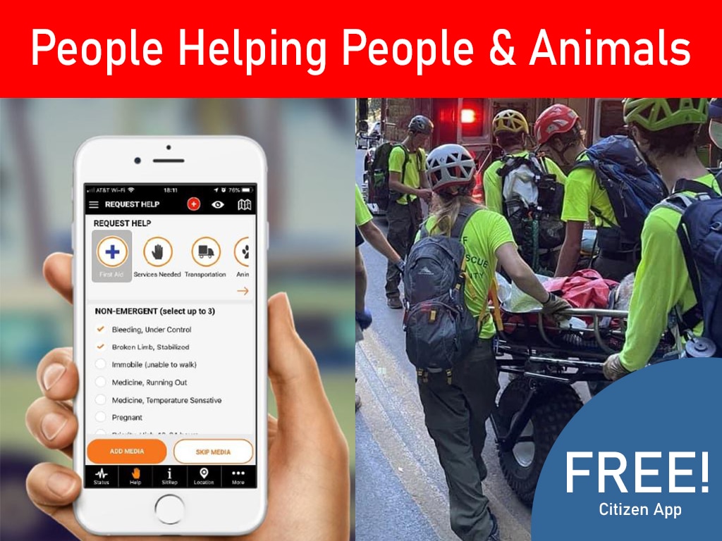
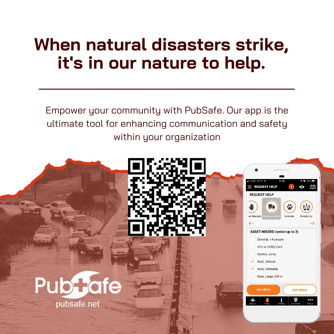
PubSafe brings two additional elements to the response process not available in a traditional ATAK deployment. PubSafe has multiple mechanisms for collecting and logging help requests. Methods includes the free PubSafe mobile app and a link unique to the organization that can be shared on social media and websites. ATAK has no direct or automated collection mechanism. ATAK relies on human data entry. PubSafe includes a work order management system that links the web portal to the free PubSafe mobile app. It enables dispatchers anywhere in the world to handle more help requests than every before. Bonus components of PubSafe include volunteer hours tracking and performance analytics for continued improvement.
ATAK is most useful when conditions, hazards, and team locations change quickly. Instead of waiting for every update to pass through one communications desk, authorized teams can work from a common map. They can exchange location data and attach operational information to specific places. Leaders can then see where resources are positioned and which tasks need attention. PubSafe shows team members on the map and can show help requests coming directly from citizens. This enables responders to use initiative to help when and where needed in the absence of guidance. This is especially helpful immediately following a disaster when chaos is the norm.
Shared situational awareness in the field
A responder might mark a blocked road, damaged facility, evacuation area, staging location, or reported hazard. Because the information is tied to a location, it provides context that a text message or radio update may not. Team location data can also help leaders identify coverage gaps, redirect a nearby crew, or coordinate movement around an active hazard.
A really helpful feature of ATAK is the ability to install a custom add-in that enables live streaming of data from drones or possibly handheld devices. This can help with situational awareness if the cell network is capable of handling the traffic. The downside to live streaming is the last of historical data to review. If you miss the live stream, you have missed the information if a media server is not deployed to provide file storage. In PubSafe there is not live streaming but video and photos can be uploaded with SitReps for review after the fact.
Geospatial information is useful only when teams understand its status. Markers need clear names, timestamps, ownership, and update rules. A map crowded with stale or unverified symbols can create a new source of confusion. Data governance is therefore part of operational readiness, not a task reserved for the technical administrator.
Information sharing across agencies
Disaster response often involves emergency management, fire services, law enforcement, public works, search-and-rescue teams, nonprofits, and other partners. A shared ATAK environment can distribute relevant markers, imagery, reports, and task information across participating groups, subject to the deployment’s permissions and security controls.
That cross-agency model should be agreed before an incident. Managers need to define which data each partner can view, create, or update. They also need a process for resolving conflicting information. ATAK can support the workflow, but it does not replace interagency agreements, command decisions, or accountable leadership.
Which Mapping and GIS Features Matter in the Field?
The most useful ATAK mapping features are the ones that help a team answer a real operational question. Georeferenced imagery, KML or KMZ overlays, GPX routes, offline maps, and three-dimensional views may support decisions about hazards, access, search sectors, and assignments. Each feature must be compatible with the mission, device, data, and training plan.
Maps become operational tools when they help a team answer three questions: Where are our people? What has changed? Which action should happen next? ATAK can support those questions through georeferenced imagery and other geospatial infrastructure, but the deployment must define how the information will be used.
Overlays turn map data into assignments
Operational overlays may include KML or KMZ files for boundaries and locations, GPX tracks for routes, and approved layers for infrastructure, hazards, staging areas, or search sectors. Before an incident, managers should decide which formats and sources are compatible, who can publish updates, and how stale or conflicting data will be identified.
During an incident, a clearly named and validated overlay can turn a broad map into a practical assignment. Teams might inspect a corridor, avoid a hazard area, or report conditions within a sector. The overlay does not make the decision by itself. It gives trained personnel a common geographic reference for making and communicating the decision.
Offline and 3D maps require preparation
Offline maps can preserve access to selected geographic information when connectivity is limited. They must be downloaded, updated, stored, and tested on the devices responders will actually use. Three-dimensional mapping may add terrain or elevation context in the right mission, but it also introduces data, device, and training requirements. Neither capability should be assumed to exist in every ATAK deployment. The PubSafe app currently does not operate offline but plans are in place to enable some offline use in 2027.
Validation should be part of every exercise. Confirm that coordinates align, imagery is current enough for the mission, overlays display correctly, offline packages open without service, and teams interpret the same symbology. Then connect each layer to a decision rule and an accountable owner. This keeps GIS from becoming another ungoverned information stream.
How Can SAR Teams Use ATAK to Coordinate?
Search-and-rescue teams can use ATAK to share positions, mark last-known locations, divide search sectors, identify hazards, coordinate routes, and record updates on a common geospatial picture. Teams still need agreed marker conventions, role-based permissions, communications backups, and hands-on exercises before relying on a configured ATAK environment during a mission.
Search-and-rescue work depends on a shared understanding of the terrain, the mission, and each team’s current position. Coordinators can mark a last-known location, access points, staging areas, medical sites, hazards, and areas already searched. Team leaders can then assign sectors or routes and communicate changes as the operation develops.
Shared markers support a repeatable workflow
The value is not simply placing points on a screen. Teams need agreed conventions for naming and updating markers. A coordinator might distinguish between unsearched areas, completed searches, hazards, and locations requiring follow-up. Everyone should know which information is current, who owns each assignment, and how to report a change when a route becomes unsafe.
A government search-and-rescue resource documents TAK use for team coordination, while research from West Virginia University describes work advancing search-and-rescue missions with unmanned systems. These examples show practical uses, not a guarantee that every deployment will produce the same results. Equipment, network design, permissions, training, and operating procedures determine what a team can safely do.
Training and safety controls matter
Users should train on the specific configuration they will use during an incident. Exercises should cover map interpretation, information-sharing conventions, device preparation, privacy expectations, marker updates, and troubleshooting. Teams should also test what happens when a device, positioning source, or communications path fails. Readiness comes from governance and rehearsal, not from installing an app alone.
What Happens When Connectivity Is Degraded?
When connectivity is degraded, ATAK may continue supporting field coordination through prepared offline data or configured alternate networks, but this is not automatic. Emergency managers should define what information must remain available, test devices without cellular service, establish synchronization rules, and document the limits of every fallback channel.
Disaster communications rarely fail in one predictable way. A team may have intermittent cellular service, limited bandwidth, damaged infrastructure, or a local network that reaches only part of the operating area. Planning for those conditions means deciding what information must remain available, which channels can carry updates, and how teams will reconcile changes after devices reconnect.
Build an offline data plan
Before deployment, prepare the information teams may need without a live connection. This can include map packages, operational boundaries, routes, hazards, staging areas, and other approved geospatial layers. Keep the package focused. Large or outdated files can consume storage and create confusion about which information is current.
Define what each user can view and update locally. A device may record a marker while disconnected, yet other users will not see it until a supported synchronization path becomes available. Establish a rule for reconciling edits, identifying the authoritative version, and recording changes that could not be synchronized.
Use alternate channels carefully
Alternate communications may include radio, satellite, local wireless networks, or project-specific mesh systems. One university project explored integrating ATAK with LoRa mesh radios for off-grid data sharing. That example does not mean every ATAK deployment includes LoRa. Low-bandwidth links may carry short updates more reliably than large imagery or frequent position data.
Field testing should reproduce likely failure conditions. Turn off cellular service, test prepared map packages, record observations, exchange updates through each fallback channel, and measure what arrives after reconnection. Include volunteers and partner agencies when appropriate so the plan covers the wider response ecosystem. PubSafe’s public map and community-facing tools can be considered alongside tactical procedures when planning broader information flow.
How Should Emergency Managers Deploy ATAK?
A deployment plan should turn a capable situational-awareness tool into a repeatable operating practice. Use this sequence to keep the focus on mission fit, accountable data use, and tested field procedures.
- Define the mission and users. Specify the incidents, operating areas, and decisions the system must support. Identify who needs access, including emergency-management staff, SAR teams, public-safety partners, CERT volunteers, or NGO coordinators.
- Establish map and data governance. Choose authoritative basemaps, imagery, boundaries, facility data, and incident layers. Assign a steward for each dataset and define how stale or conflicting information will be handled.
- Assign roles and permissions. Name an operational lead, technical administrator, data steward, and training owner. Clarify who creates markers, approves shared information, distributes updates, and removes obsolete content.
- Plan primary and fallback communications. List primary, secondary, and emergency channels. Define which information must move when cellular or internet service is unreliable. Test the specific hardware and coverage instead of treating a possible integration as a guarantee.
- Train by role and scenario. Give users hands-on practice with the functions they will actually use. Include map interpretation, device preparation, privacy expectations, information-sharing conventions, and troubleshooting.
- Exercise the complete workflow. Run a tabletop exercise, then a field test with changing objectives, incomplete data, new teams, and a communications outage. Check whether users can find current information and report changes.
- Conduct an after-action review. Record what worked, where authority or information broke down, and which steps depended on one expert. Assign improvements to owners and test them before the next operational period.
| Capability | Operational use | Readiness requirement |
|---|---|---|
| Shared locations. | Track teams and mark hazards or assignments. | Device, permission, and privacy controls. |
| Geospatial overlays. | Show boundaries, routes, sectors, and assets. | Validated formats, sources, and update rules. |
| Offline data. | Preserve selected maps during service disruption. | Preloading, device testing, and synchronization rules. |
| Community coordination. | Connect reports, volunteers, NGOs, and CERTs. | Clear handoffs to authorized response organizations. |
How Do ATAK and PubSafe Fit a Layered Response?
ATAK and PubSafe serve different layers of disaster response. ATAK supports professional, tactical situational awareness for trained field teams. PubSafe helps connect citizens, volunteers, NGOs, CERT teams, and public-safety organizations through community-wide coordination and SOS capabilities. Clear roles let each platform support its intended audience without treating either as a replacement for the other.
Effective disaster response rarely depends on one platform serving every person and every operational need. ATAK can help tactical teams work with geospatial information and coordinate at the mobile edge. PubSafe can help organize reports and communication from the wider community. This separation creates a clearer operating model than asking one tool to do everything.
Before an incident, emergency managers can define which teams use tactical systems, which organizations coordinate community support, and how information should move between those groups. This is a governance and training decision. The systems should not be assumed to integrate automatically. Agencies retain responsibility for their own operational systems, escalation rules, data permissions, and safety decisions.
During response, professional teams can use established tactical workflows to interpret field conditions and coordinate missions. At the same time, PubSafe can help connect citizens, volunteers, NGOs, CERTs, and public-safety organizations. A community report may identify a need that deserves attention, while authorized responders determine the appropriate operational action. Learn more about the PubSafe disaster response platform and its community coordination model.
The layered model extends into recovery. Community organizations may continue coordinating welfare checks, volunteer activity, resource requests, and public updates while tactical teams demobilize or shift to another mission. People who need community situational awareness and emergency reporting can also download the free PubSafe app.
Frequently Asked Questions
What is ATAK and how is it used in disaster response?
ATAK, or Android Team Awareness Kit, is an Android-based geospatial capability that gives field teams a shared view of locations, information, and operational activity. It can support responder situational awareness and mobile-edge collaboration, helping agencies coordinate field work in complex environments. DHS describes TAK collaboration at the mobile edge.
How does ATAK support emergency communication in disasters?
ATAK may support coordination when Wi-Fi or cellular service is unavailable, depending on the configured network, devices, and deployment plan. Some projects pair ATAK with mesh technologies such as LoRa for off-grid data sharing. These capabilities require advance configuration, testing, and a defined fallback plan. One academic project documents an ATAK and LoRa mesh integration.
What role does ATAK play in search-and-rescue coordination?
SAR teams can use ATAK to share positions, mark areas of interest, coordinate assignments, and maintain a common operational picture. Documented resources include urban search-and-rescue and overland operations. Teams should still define procedures, permissions, training, and communications backups before relying on a deployment during a mission. A government SAR resource describes TAK use for team coordination.
How do mapping and GIS tools work within ATAK?
ATAK can use georeferenced imagery and geospatial infrastructure to support field awareness. Depending on the deployment, teams may configure offline maps, KML or KMZ overlays, GPX data, and three-dimensional views. Data sources and formats should be validated because available layers and capabilities vary by device, software configuration, and mission.
How does PubSafe complement tactical tools like ATAK?
ATAK is designed primarily for professional and tactical situational awareness, while PubSafe focuses on community-wide coordination among citizens, volunteers, NGOs, CERT teams, and public-safety organizations. Used together, they can support different response layers. PubSafe complements existing systems rather than replacing ATAK, CAD, or 911.
Get Started With Community-Wide Coordination
ATAK can support professional situational awareness and field coordination, while PubSafe adds a community-wide layer for citizens, volunteers, NGOs, and CERTs. To discuss how PubSafe may fit your coordination model and learn about the free PubSafe app, contact PubSafe.