A flooded roadway reported by a resident, a welfare-check request entered by a partner agency, and a volunteer team available two miles away are not separate pieces of information. They are one operational decision. Live disaster response mapping software gives emergency managers and community organizations a shared view of those facts while they can still change the outcome.
During a disaster, the map is not just a display. It becomes the working picture for command staff, dispatch leaders, field supervisors, volunteers, and residents. When it is connected to the right intake, assignment, communication, and recordkeeping workflows, it helps teams move from scattered reports to accountable action.
Why a static map falls short during an incident
Many organizations begin with familiar tools: a GIS layer, a shared spreadsheet, text messages, email, paper forms, and a collection of phone calls. Each tool may be useful on its own. The problem is that none of them reliably answers the questions that matter most during fast-moving operations: What is happening now? Where is it happening? Who owns the next action? Has anyone confirmed the result?
A static map can show evacuation zones, shelters, road closures, and critical facilities. That is valuable baseline information. But a live operation also requires changing information from the field: damaged homes, downed power lines, stranded animals, supply needs, open work orders, responder locations, and citizen reports.
Without a connected workflow, staff often spend critical time reconciling duplicate reports, calling for status updates, and manually moving information from one system to another. The operational picture falls behind the event. A map that is current but disconnected from assignments has a similar limitation. It shows the problem without helping the organization manage the response.
What live disaster response mapping software should do
The right platform should connect the map to the work of disaster coordination. It should make it practical to collect reports, validate information, assign resources, track progress, and preserve a record of what occurred.
Bring field and community reports into one view
Residents are often first to see changing conditions. A blocked intersection, a neighborhood without power, an elderly neighbor needing assistance, or an animal shelter running short on supplies may be visible locally before it reaches an emergency operations center.
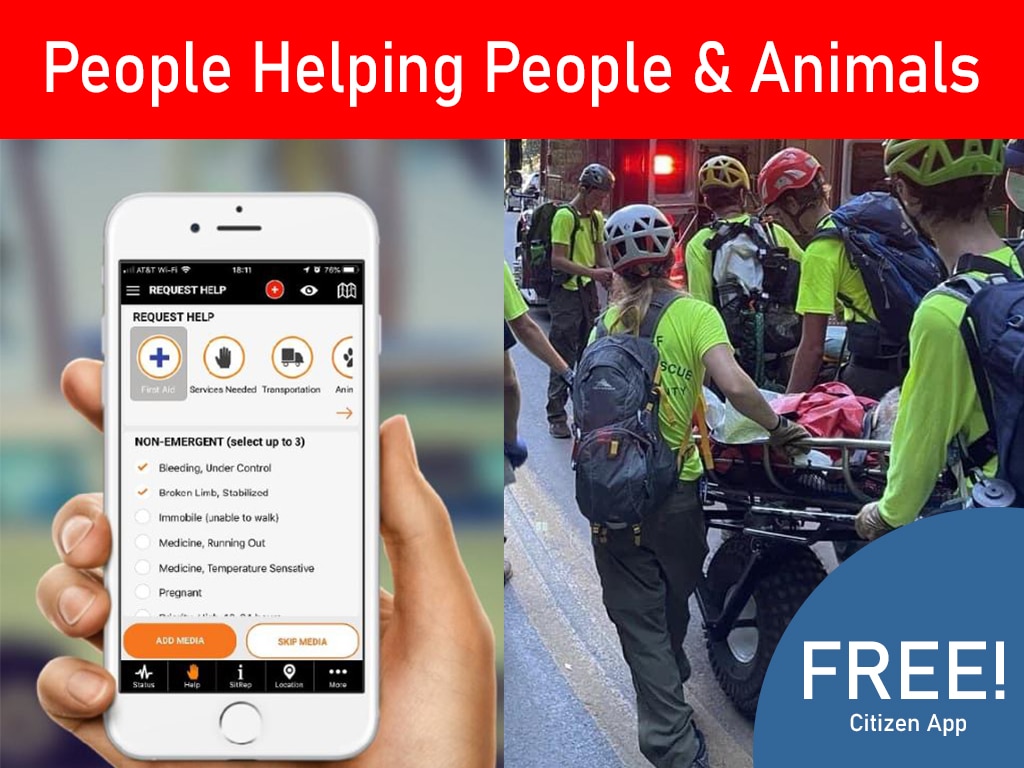
A citizen-facing reporting tool gives the public a structured way to share what they see. Reports should capture the location, issue type, details, time, and supporting photos when appropriate. They should then enter an organized review process rather than becoming another unmanaged stream of messages.
This does not mean every public report is immediately treated as verified. Emergency teams need the ability to assess, prioritize, merge duplicates, and protect sensitive information. A useful system preserves the original report while allowing authorized staff to update its status, add operational notes, and connect it to a request or mission.
Turn map points into accountable work
An icon on a map is not an assignment. Live disaster response mapping software should allow coordinators to create and manage help requests, work orders, dispatch activity, and missions from location-based information.
For example, a cluster of resident reports about flooded access roads may lead to a road-status verification task. A request for welfare checks may be assigned to a trained team with the correct credentials and contact information. A supply delivery can be dispatched, documented, and marked complete with notes from the field.
That connection matters for accountability. Coordinators need to see not only where needs exist, but also whether they are unassigned, in progress, delayed, resolved, or awaiting verification. Field teams need enough context to act safely without relying on fragmented text-message chains.
Show the people and resources behind the response
A response map is stronger when it reflects operational capacity, not just incident volume. Teams should be able to identify available volunteers, qualified members, equipment, facilities, staging locations, and partner resources relevant to the mission.
Credentials and training records are especially important. A volunteer may be willing to help, but the assignment must match their role, authorization, skills, and current status. Tracking these records inside the same operational environment reduces the risk of assigning people without the preparation or approval required for the work.
Location visibility also requires judgment. Showing every responder’s real-time position may be useful for some field operations, but it may be unnecessary or inappropriate for others. Role-based access, configurable views, and clear policies help organizations balance coordination with privacy and responder safety.
How mapping improves the operational cycle
Live mapping delivers the greatest value when it supports the full cycle of an incident rather than a single command-center moment.
Before an event, agencies and organizations can organize known assets, volunteer profiles, training records, facilities, zones, and response plans. This creates readiness before conditions deteriorate. Teams do not have to build the operational picture from scratch while managing an active emergency.
During response, incoming reports and internal updates create a changing view of needs and activity. Incident coordinators can prioritize geographically, identify concentrations of requests, avoid duplicating assignments, and direct teams using current conditions. Command staff can see where demand is growing and where resources may need to shift.
During recovery, the same records support follow-up. Open requests can be revisited, work completed by volunteers can be documented, and unresolved issues can remain visible instead of disappearing in a closed message thread. Reliable records also support after-action review, partner reporting, reimbursement documentation, and improved planning for the next event.
A practical disaster mapping workflow
A dependable workflow starts with intake. Reports may come from the public, a call center, field teams, partner organizations, or agency personnel. Each report should receive a location and category, then be reviewed against existing information to reduce confusion and duplication.
Next, staff establish priority. Life safety, access, medical needs, evacuation conditions, critical infrastructure, and vulnerable populations may require immediate attention. Other tasks can be queued by severity, geography, available resources, or operational period. The system should support local decision-making rather than force every organization into the same priority model.
The third step is assignment. Coordinators match the task with an available person or team, confirm qualifications, provide instructions, and record the mission status. Dispatch updates, field notes, and photos should return to the same operational record whenever possible.
Finally, teams verify closure. A request is not complete because a unit was sent. The organization needs to know what was found, what action was taken, whether additional help is needed, and whether the resident or reporting partner received an appropriate update. This is where a map becomes a service-delivery tool rather than a visual dashboard.
What to look for when evaluating a platform
The best choice depends on your organization’s size, mission, staffing model, and existing public-safety systems. A county emergency-management department may need multi-agency coordination and formal incident documentation. A CERT or nonprofit may prioritize volunteer mobilization, help-request management, and community reporting. Both need a clear picture, but their workflows can differ.
When evaluating software, look beyond map layers and dashboards. Ask whether the platform can manage contacts, volunteers, certifications, training, requests, work orders, dispatch activity, alerts, and reporting in a connected way. Confirm that it supports secure cloud access, role-based permissions, and mobile use for distributed teams.
Also ask what happens when the incident volume rises. Can staff triage reports quickly? Can multiple users work without overwriting each other? Can command-level users see progress without interrupting dispatch or field supervisors? Can residents participate through a simple, trusted channel without gaining access to sensitive operational information?
PubSafe is designed around this connected model: organized readiness in blue-sky conditions and structured coordination when gray-sky operations begin. Its free citizen app helps turn local observations into actionable intelligence while authorized responders manage the work behind the map.
Build trust through visible follow-through
Communities do not judge disaster operations only by the number of reports received. They remember whether someone acknowledged their need, whether responders arrived with accurate information, and whether unresolved problems remained visible until they were addressed.
A well-run mapping system helps make that follow-through possible. It gives responders a common operational picture, gives leaders defensible records, and gives residents a meaningful way to contribute without creating chaos. When people, requests, and field conditions are connected in one place, communities can respond faster and more effectively – for people, animals, and the places they call home.