When the Sanibel Causeway collapsed, it did more than just destroy a bridge; it physically cut off an entire community, creating an information black hole at the worst possible moment. This was just one of many instances during Hurricane Ian where a breakdown in communication had life-or-death consequences. From shifting forecasts that delayed evacuation orders to uncoordinated aid efforts, the storm proved that information is as critical as any physical resource. We’re exploring this challenge through 10 facts about Hurricane Ian that demonstrate how information gaps can cripple a response. These examples underscore the urgent need for a unified platform where citizens, NGOs, and official agencies can share real-time intelligence.
Thank you for reading this post, don't forget to install the free PubSafe mobile app and subscribe!
Hurricane Ian 2022: The Essential Facts
Hurricane Ian is one of Florida’s most expensive and deadly hurricanes in in a long time. Decades of development in low lying coastal areas by people intent on having ocean front view or water access, has led to a very tenuous environment for hurricane damage. In Ft. Meyers thousands of small, manufactured homes are scattered in low flat areas within miles of the ocean. Hurrican Ian presented a worse case scenario with high winds pushing water onto land in a storm surge that exceeded 10′!
")
In any major hurricane like Hurricane Ian there are literally thousands of lessons learned at all levels, from individual responders to FEMA and everywhere in between. What is evident is society cannot build in these areas and not expect major losses over time. The Gulf Coast states have made changes to improve survivability of structures and lives but the real lesson is to not build and rebuild in these areas. Returning them to their natural state as a buffer to communities inland is the only way to avoid $45,000,000,000 disasters.

Storm’s Timeline and Strength
To truly understand the scale of Hurricane Ian, it helps to look at its journey from a tropical disturbance to a historic storm. Its rapid intensification and destructive path across the Caribbean and southeastern United States serve as a powerful reminder of why real-time tracking and coordinated response are so critical. When communities and response teams have access to shared information, they can prepare more effectively for what’s coming and react more quickly when the storm hits. This timeline shows just how quickly a threat can evolve, leaving little room for communication delays or information gaps.
Origin and Formation
Hurricane Ian began its life cycle as a tropical disturbance in the central Caribbean Sea on September 23, 2022. Fed by the incredibly warm ocean waters, it quickly organized and gained strength. This initial phase is a crucial window for emergency managers and organizations to begin mobilizing resources and alerting communities. For residents in the potential path, this is the time to review evacuation plans and prepare their homes, as the storm’s intensity can escalate with alarming speed, turning a distant threat into an imminent danger in just a matter of days.
Storm Category and Wind Speed
By the time it made landfall in Florida on September 28, 2022, Ian had exploded into a monstrous Category 4 hurricane. It crashed ashore with sustained winds of 155 mph, just two miles per hour shy of the most dangerous Category 5 classification. Winds this powerful don’t just damage buildings; they can completely destroy them, turn debris into deadly projectiles, and cause widespread, long-lasting power outages. The sheer force of the wind alone was enough to reshape coastlines and communities, leaving a trail of devastation that would take years to repair.
The Full Path of the Storm
Ian’s path of destruction was long and varied. It first slammed into western Cuba as a Category 3 storm, knocking out the island’s entire power grid. After regaining strength over the Gulf of Mexico, it carved through Southwest Florida as a Category 4 hurricane. Even after weakening over land, it wasn’t finished. Ian re-emerged into the Atlantic, making a final landfall in South Carolina as a Category 1 hurricane. This multi-state impact underscores the need for seamless communication across different agencies and jurisdictions, showing exactly how PubSafe works to connect teams on a unified platform.
A Name Retired from History
Due to the catastrophic damage and significant loss of life, the World Meteorological Organization retired the name ‘Ian’ from its rotating list of Atlantic hurricane names. This is a somber honor reserved only for the most devastating and deadly storms. Retiring a name ensures it won’t be used again out of respect for the victims and survivors. It permanently cements the storm’s legacy in history, serving as a benchmark for meteorologists and a painful memory for all who lived through it.
The Human and Financial Cost
While the scientific data tells one story, the true measure of Hurricane Ian’s impact lies in the lives it upended and the communities it fractured. The storm left behind a staggering toll, not just in dollars, but in the human cost of loss, displacement, and the long, arduous journey of recovery. These numbers represent families, homes, and livelihoods that were forever changed. In the face of such widespread devastation, the power of community and organized aid becomes the most critical resource for helping people rebuild their lives from the ground up.
The Death Toll
Tragically, Hurricane Ian was directly and indirectly responsible for 161 deaths, with 150 of those fatalities occurring in Florida. This made it the deadliest hurricane to strike the state since the 1935 Labor Day hurricane. Each number represents a person whose loss left a hole in their family and community. This grim statistic is a stark reminder of the immense power of nature and the life-or-death importance of heeding evacuation orders and having robust search-and-rescue operations in place immediately following a storm’s passage.
Record-Breaking Financial Damage
The economic devastation was almost incomprehensible. With an estimated $112 billion in damages, Hurricane Ian became the costliest hurricane in Florida’s history and the third-costliest in the history of the United States. This figure accounts for destroyed homes, obliterated businesses, and crippled public infrastructure. For countless families and small business owners, the financial ruin meant starting over from scratch. The long-term recovery requires a massive, coordinated effort from government agencies, non-profits, and community volunteers to manage the immense task of rebuilding.
Widespread Power Outages
The storm’s ferocious winds and flooding crippled the power grid, leaving more than nine million people across the U.S. in the dark. In Florida alone, over 2.4 million residents lost electricity, with some areas remaining without power for weeks. This created a secondary crisis, as a lack of power affects access to clean water, food refrigeration, medical equipment, and communication. In these situations, effective volunteer coordination is essential for conducting wellness checks on vulnerable residents and distributing vital supplies like water, ice, and batteries.
Specific Impacts and Consequences
Beyond the staggering statistics, the on-the-ground reality of Hurricane Ian was a story of terrifying storm surges, shattered infrastructure, and hidden dangers that lingered long after the winds subsided. These specific consequences reveal how a single disaster can unravel every aspect of daily life, highlighting why detailed, real-time information from the affected area is invaluable for first responders and relief organizations. When you can see the specific needs of a community, you can deliver the right aid to the right place at the right time.
Catastrophic Storm Surge and Flooding
One of Ian’s most destructive weapons was its storm surge, a massive wall of water that reached heights of 10 to 15 feet in some coastal areas of Florida. This wasn’t just flooding; it was the ocean moving inland with incredible force, sweeping homes off their foundations and submerging entire neighborhoods. The surge carried boats miles inland and inundated areas that had never experienced flooding before. Visualizing this damage on a public map helps teams identify the hardest-hit zones and direct rescue and relief efforts to where they are needed most urgently.
Critical Infrastructure Damage
The combined force of wind and water decimated critical infrastructure, effectively cutting off entire communities from the outside world. The causeways and bridges connecting barrier islands like Sanibel and Pine Island to the mainland collapsed, isolating thousands of residents and making rescue operations incredibly difficult. Beyond bridges, the storm damaged hospitals, water treatment facilities, and cell towers. When citizens have the ability to report an incident like a washed-out road or downed power line, they provide crucial intelligence that helps authorities prioritize repairs and clear paths for emergency services.
Health and Environmental Risks
The dangers did not disappear when the storm moved on. The warm, stagnant floodwaters left behind became a breeding ground for dangerous bacteria, creating a serious public health risk. Health officials warned of a significant increase in cases of Vibrio vulnificus, a flesh-eating bacteria that can enter the body through small cuts and cause life-threatening infections. This secondary threat put both residents wading through floodwaters and recovery workers at risk, adding another layer of complexity and danger to the already challenging post-storm environment.
What Did We Learn From Hurricane Ian?
- Think big because the problems are big. Barges and trains of supplies are needed, not truckloads.
- Forcing people to leave is a real consideration.
- Increase short-term shelters by 10x.
- Buy and maintain large areas to stage recovery assets and people with central, shared, logistics.
- Buy and maintain large housing units for displaced people and have a transportation plan to get them their.
- Offer central services at temporary housing units.
- Coordinate with NGOs to support specific areas and tasks.
- Fund NGOs or provide resources such as fuel and food.
- Unify communications and include the NGOs.
- Have a plan for rebuilding, or not, before a disaster strikes.
")
Analyzing Preparations and Warnings
When a storm the size of Ian is on the horizon, preparation is everything. The moments before landfall are a critical window for officials to communicate risk and for residents to take action. This involves a massive logistical effort, from broadcasting warnings to managing the physical movement of people and resources. The effectiveness of these early stages can directly influence the storm’s ultimate human cost. For Hurricane Ian, the preparations were extensive, but they also revealed gaps in communication and timing that offer important lessons for future events.
Evacuations and Closures
In the days leading up to Hurricane Ian’s landfall, authorities issued evacuation orders across multiple counties. Ultimately, about 50,000 people were evacuated, and officials opened shelters to provide a safe haven for those leaving their homes. This process is incredibly complex, requiring clear communication channels to inform the public, manage traffic flow away from coastal areas, and ensure shelters are adequately staffed and supplied. It’s a testament to the hard work of emergency managers and community organizations who step up in these critical moments. Effective volunteer coordination is essential to making sure these shelters operate smoothly and can handle the influx of people seeking safety from the storm.
Challenges with Warning Timelines
Despite the best efforts, the warning system faced significant challenges. The storm’s projected path shifted, leading to delays in issuing mandatory evacuation orders in some areas, particularly in Lee County, where Ian eventually made landfall. As a result, some residents reported they either didn’t receive the orders in time or felt it was too late to leave safely. This highlights a crucial need for a more agile and direct communication system. When citizens can report incidents and conditions in real-time, it creates a clearer, on-the-ground picture that helps everyone—from neighbors to emergency managers—make faster, more informed decisions when every second counts.
The Road to Recovery
The aftermath of a major hurricane is often more challenging than the storm itself. The road to recovery is a long and arduous journey that involves immense coordination, financial resilience, and emotional strength. For communities hit by Hurricane Ian, this process began the moment the winds died down, with search and rescue teams deploying into devastated neighborhoods. However, the recovery was complicated by immense financial hurdles and the unfortunate arrival of another storm just weeks later, testing the limits of responders and residents alike.
Coordinating Aid and Restoring Services
Immediately following the storm, a massive response effort was launched. Search and rescue teams, first responders, and utility workers moved into the hardest-hit areas to save lives and begin the painstaking process of restoring essential services. This phase is a logistical puzzle, with countless different agencies, NGOs, and volunteer groups working simultaneously. A unified disaster response platform becomes invaluable here, helping to deconflict efforts and ensure that aid is distributed efficiently. By connecting public safety agencies with non-profits and community teams, you can make sure resources like food, water, and medical supplies get to the people who need them most without delay.
Insurance and Financial Hurdles
The financial toll of Hurricane Ian was staggering, not just for the state but for individual families. The storm’s destruction led to an overwhelming number of insurance claims, and unfortunately, many insurance companies struggled to keep up. It’s reported that around 200,000 claims could not be paid, leaving homeowners in a desperate situation. This financial fallout underscores the importance of accurate and timely damage assessments. When response teams can quickly document the extent of the damage, it helps create a clearer operational picture for recovery agencies and provides residents with the necessary information to begin navigating the complex financial aid and insurance processes.
Compounding Disasters: The Arrival of Hurricane Nicole
As if recovering from one of the most powerful hurricanes in Florida’s history wasn’t enough, another storm, Hurricane Nicole, struck the state just weeks later. While weaker than Ian, Nicole brought more rain and coastal flooding, causing additional damage to structures that were already weakened and vulnerable. This event served as a harsh reminder that disaster recovery is not a linear process. Communities are often forced to respond to new threats while still reeling from the last one, highlighting the need for resilient infrastructure and a response framework that remains active and vigilant throughout the entire hurricane season.
Scientific Context and Government Scrutiny
Hurricane Ian wasn’t just another storm; it was a signal. Its rapid intensification and destructive power prompted serious discussions among scientists about the role of climate change in modern weather events. At the same time, the scale of the disaster led to intense scrutiny of the government’s response at both the state and federal levels. These conversations are vital, as they push us to understand the changing nature of these threats and refine our strategies for preparing for and responding to them in the future.
The Connection to Climate Change
Scientists have pointed out that Hurricane Ian’s strength and longevity were likely amplified by unusually warm ocean temperatures in the Gulf of Mexico. Global warming contributes to warmer seas, which act as fuel for hurricanes, allowing them to intensify rapidly and sustain their power for longer periods. This scientific context is crucial because it suggests that catastrophic storms like Ian may become more common. Understanding this connection helps shift our focus from simply reacting to disasters to proactively building more resilient communities that are prepared for the weather of tomorrow, not just the weather of yesterday.
Investigating the Government’s Response
In the wake of the hurricane, the U.S. Congress held hearings to examine the effectiveness of the government’s response, with a particular focus on the Federal Emergency Management Agency (FEMA). This kind of review is a standard and necessary part of the post-disaster process. It’s not about assigning blame, but about identifying what worked and what didn’t. These investigations often reveal the need for better coordination between federal, state, and local agencies. By encouraging different groups to register on a shared platform, we can help bridge communication gaps and create a more cohesive and effective response network for the next major event.
What the Data Tells Us
Documenting and storing lessons learned in a database allows for data scientists to explored trends, spot inefficiencies and more. By structuring the response through a platform like PubSafe, data is automatically captured. Over time the data set grows to be a valuable resource to understand the nuances of an overall response effort as well as an individual organization.

Mistakes Made Going to Hurricane Ian
Listen to Eron describe the mistakes he made going to Hurricane Ian so you can stay safe and be more effective.
Full Transcript of Video
Hey everybody Aaron here with pub safe, and I wanted to do a video for you on some lessons learned. every time I I had into a disaster area, even for short periods of time. I pick up new information in. My goal is to go down and help to some extent but also to learn, understand see what’s going on and then try to come up with technical solutions to these particular problems that. NGOs and people that are they’re hardcore.
can utilize to be more efficient at what they do. And yesterday I traveled down to hurricane Ian and one of my Teammates One of my employees. work’s down and lose down there. And she was impacted and we lost contact with her So I wanted to go check on Kim make sure Kim was okay And see what we could do for her. And spend a couple of hours doing that traveling to her house through some deep water and having to navigate around and find different ways because certain roads were too flooded to get through And things like that.
And those were all great lessons And I wanted to bring some of those lessons to you. So if you are either heading out yourself or as a team or with somebody else or with an NGO whatever the case is that you can benefit from my lessons learned. And the first thing is. You know if you’re going to go down into a flooded situation, ideally you want to have a high water vehicle You know, a Jeep something that’s jacked up a truck.
you know it’s hard enough to get through a lot of areas and you’ve gotta be super super careful. I’m not encouraging it but. You know if you’re going to go down a flooded road and you might as well be in the right vehicle. the disadvantage to a high water vehicle as I saw yesterday was that a lot of times there’s there’s cables hanging down across the road. Whether they be telecom cables or, power cables or, support cables.
Sometimes they can be heavy duty and I’m no electrician. So I don’t know if they’re power cables or otherwise somebody that was with me. at one point you had told me that they were telecom cables. which seemed to be accurate but, you know, unless you’re a utility worker you just don’t know. Right So you just have to assume everything’s hot.
but the higher the truck and the more likely you are to hit one one of those are the harder it is going to be Get under some that have been pulled down because of trees falling on the poles of the lines where everything’s sagging or something snapped off and is now draped across the road. There was probably a half dozen of those…
situations You know when I was up there. So a high water vehicle Number two is you’ve got to have a way to do do mapping and I didn’t. Download the offline maps before I went out and huge mistake. you know I was trying to use my phone obviously there was no cell phone service and that’s a big inconvenience you need to know and think through the fact that you’re not going to have any connectivity So what does that mean for you? Well mapping is one of those things If your phone is your primary mapping tool, Yeah you don’t have a GPS in your vehicle.
You’ve got to be very attune to you know what you’re going to need to be able to get around. And fortunately my truck I have a navigation system so I had map data that I could use, but it wasn’t. As good as what I’m used to with you know, Google. So think that through download those maps there’s maps.me is one that a couple people have recommended OSM maps and Google maps You know it can all be…
downloaded. Offline So you can at least see your position You can see the roads. And that was super critical to being able to find my way around. different areas And on this particular map you can see here, like I was trying to get to. this area over here…
But with the canal system that they have there, actually I think it was somewhere back over here So I had to come down. You know these roads didn’t come across This road was flooded So there was no shortcuts to get through here. So I ended up having to come down circle back around and take another road around the rotunda and come back over here end up over in here Something like that. And without being able to see the streets it would have been very very hard to try to reroute and work off a roadmap like a paper map or something Or if you didn’t have a map at all you just wasn’t going to happen You weren’t going to get to where you wanted to go. You can get to an area and maybe help but you’re not going to be able to get to a specific address.
So navigation in figuring that piece out it’s usually important. the other thing about no cell coverage is you’ve got no communication How do you know where to go? Who’s telling you and how are you getting that information? So if you know that you’re going into an area without cell coverage then
stay tuned in the end of the video I’m going to talk to you about something new that I’m testing now, and I’m really kind of excited about it Cause I think it’s got huge potential. And I’ll tell you about that but you know if you’re just going into these areas with regular technology you better print something out before you head in. And what would I take Well AI would take a list of contacts First of all, who are the people that you need to be communicating with Because if you know maybe if they’re in your phone or your phone dies then how do you potentially get help? and take backup batteries and chargers and stuff like that Obviously. But sometimes the printed copy is just a good backup to fold up and just throw on your dashboard or in the glove box.
so, shelters that’s another one Where are the shelters? I encountered this yesterday I was helping a woman who had lost everything in a trailer park. And you know she asked me to come in and help her. All right I volunteered And then she said well you can come inside and help me. I walked inside and there was nothing that she could do for her place It was just a total loss.
So at that point I you know I felt obligated to try to figure out how do I get her somewhere and where do I, where do I take her? You know what shelter is nearby. And I had no idea. I had no ability to search for
shelters in the area because I had no cell phone service no internet connection Right. And I hadn’t printed any of that So I had no idea So I had to ask a couple of people and some people. most people had no clue, which is surprising considering the situation that they were just in. but you know I got the names of a couple of places and it worked out with this with this person. we were able to actually travel over to…her friend’s house.
Which I’ll cut some video in You can see it was like three feet deep just to get to her friends. You know apartment. but she had a livable place. At that point So I was able to drop her off and then move on to two other locations So, shelter addresses and names and things like that That’s information that people out there are asking for. You know how do I get here Where do I go What do I do I mean these people walk around in a days They just lost everything.
the people in the trailer park that I was at you. They had seven feet of water in there You know from the ground their trailer was up about three feet and they had another four feet So their waist deep in water. All night long in the dark in howling winds You know thinking they’re going to die If they didn’t die from shock, you know and exposure then there w you know there are zombies. With nothing but the clothes on their back and one guy ran into all he had was shorts on. Shorts and shoes and that was it.
So. You know terrible terrible situation So I have those shelters. shelter information. You know are are they pet friendly whatever have that stuff in advance and ready to go. next is rally points rally stations aid stations anything like that that these NGOs are going to have, but you’ve got to know where to go when it’s in By the time you have gone through this it’s too late, you know if you’re if you’re showing up to help and you don’t have that information.
Before you head into the field. It’s too late You’re already behind the power curve Right? So get all that information
ideally if you’re working with a team. You’re going to print that off put somebody in charge of collecting that necessary information. define operational areas You know we’re going to have this group go over there on this group I go over there and start working it now. That needs to be done within the confines of the bigger picture obviously. So you can’t just go out there and do your own thing anywhere you want Anytime you want.
Yeah. you’re going to get frowned upon by. You know the government and everybody else. So you know if you’re going to join an NGO that’s great And the NGO will pave the way and hopefully be organized. If you’re not then try to work in your neighborhood work on the fringes work in the areas where the government’s not going to be working and we’ll take them a long time to get to in the case of Fort Myers what happened was.
everybody was focused on. These devastated areas Sanibel, you know, the beach down here. Fort Myers beach totally destroyed but there was still a lot of activity going on.
Easter. East of here This is all continuing to flooding getting worse actually. A day later because the rains throughout central Florida are now flowing south And these rivers. Come down in here and they get overwhelmed and I could see this on the highway as I was driving home yesterday And about this area here, the water was almost up to the highway and it was all flowing rapidly It wasn’t just trickling along These were. You know moving rivers at this point.
And if you don’t know in Florida the the entire Everglades is a river. And it flows from south to north. So all the rain from up here was flowing down here coming out And these bays flooding all the residential canals that make up these areas. they you know the canal is running through all these neighborhoods to offload water and channel water Even Here’s a really good example right here. You can see all these canals all these canals were flooded which means they started to connect in between the houses and the neighborhoods.
And that’s why the you know the flooding. Was so terrible. Next is
and this sounds really basic but have something to write on. and it’d be able to hand written information out You know they may need an address You may not be able to get a ride, but if you can tell them where the closest shelter is. You know that’s great You got to be able to hand them something so they can share. I found that, people had naturally. And gravitated towards a VFW which I thought was a great type of place for people in this situation to use as a rally point.
And hopefully your community is sets that rally point out beforehand but you know that really happens. So everybody that was coming out of these trailers that was still alive. I was standing at the VFW and then just kind of had their hands up in the air not knowing what to do and where to go and how to get water or anything It was just you know a very tough spot for a lot of people. Next is, so after you write things down you hand things out You’re trying to get people information If you can’t transport them the next thing that you can do. Is
trying to figure out what to do with the people, right Again I didn’t know So I didn’t know where to take them. And if a shelter is full or they have pets. You have to start making different decisions If you can’t do anything. to get them to a shelter. Maybe there’s just a good general public location right So maybe you start a rally point at a VFW and then you contact your higher up somehow.
either You know later in the day or through different technology. and let people know that, you know you’ve created this rally point at the VFW and people are going to be assembling there and they’re going to need transportation. So I try to pass that responsibility off to the government and potentially get some you know five 10 trucks or something and get in there and go get those people. All right So all of that being said the biggest inconvenience like I said was not having communication So I wanted to take a look at what the alternatives were. you know, I didn’t like being…
uninformed You know I was inefficient in being able to get to certain areas I didn’t know what the rules of engagement were I couldn’t check I can communicate. So I came back and immediately started to think about what are my options and what I came up with was obviously we had to have satellite communication you know having sat phones is great If you can afford one. you know more power to ya. And you know they’re thousand bucks and. 120 bucks a month but if you’re really into this and you’re well-funded satellite phone is going to work they don’t all.
work Keep that in mind. we had a backpacking trip and our guide had an emergency. He was standing in the, in the middle of a meadow. Clear blue skies and couldn’t get a satellite call through. Now he got a text message through.
So he was able to message effectively but you know you don’t always get the voice option. So, you know for the price point I was looking at something you know under 500 bucks and reasonable monthly fees. You know it may only be used once a year maybe used a couple times a year So you’ve got to take that into account. But when you hit this type of situation like hurricane. You know Ian it’s invaluable.
And
what I came up with was, the spot. X and the spot X is a satellite communication device And sorry I got to wiggle this around to get it in the right spot
…
it has a full keyboard As you can see here it has tracking it has an SOS feature. it seems to have all of the right things to make this an effective solution. And you can turn the tracking on so it’ll track every 10 minutes or so. And with that, you know, While cell services down, somebody is going to be able to see and monitor your location. So instead of asking Hey where are you or Hey who do we have in that area?
You’ll be able to constantly see where people are. And because this communication is more expensive than you use this only for a couple of days until the cellular system comes on. And or the cellular network starts to get up and running and becomes reliable enough. So. this also comes with a online account.
And also a mobile app So you can connect this to your mobile phone in the app and via Bluetooth And when you text on your phone in the spot app it relays through this and out. you can also do some preset stuff and that really what I wanted to show you because that’s. You know the way I think with pub safe and our pub safe platform. I wanted something that would mirror that and then it would easily transition from satellite communication to tell you the communication.
so this afforded that opportunity and to that. Let me show you what’s online So let me shrink that. and here’s the here’s the app just so you guys can see…
It doesn’t get huge reviews or you know high, high reviews. But it’s pretty simple And, I’ve used global star products in other applications and Globalstar does a good job at keeping it simple. which is a benefit you know a lot of times we say we want more features than we get more features and then we decide oh it’s complicated. So global star minimizes that. And in this process that we have here this is the global star account.
You can see that you can create these different status templates. So I created these different templates. Which are. of the same things that we can do in pub safe. Right either through the web portal.
If you’re a dispatcher or through the pub safe mobile app. So even though it’s not a one for one because we have more options when we do it through the pub safe app. It does provide us with the basic ability to transmit this type of information back to somebody who was working in the web. And communicate in very succinct messaging you know messages to get our point across. And somebody could then take this because when it transmits this it’s also transmitting your identity, your location the time and then this little message they could then take that and they could plug that into our.
pub safe website And if we go here…
And this could be done within the web. you know the within our portal here but you can also you know come to request assistance and then you could use that same information. To fill out the help request form. Right So this help request form, you can copy and paste the GPS coordinates in here. And then that information then comes back in and it would appear here, but also in the mobile app.
for everybody that’s using the platform to see depending on permissions that are provided So. this whole device. Is, pretty compact You can see the size of it in relation to my hand. Right So not very big It’s the full keyboard like we’re used to seeing from Blackberry sometime ago. And it’s got the canned messages It has an SOS button.
you can enable the tracking down here. Right. And you can you You know scroll through the different menus up top So, you know from that respect it’s simple to get around and the messaging capabilities are. Pretty much in line with search and rescue efforts. So,
you know…
Probably something you want to take a look at The other thing is that, we are looking at how do we integrate. The messaging coming from this and put it into the pub safe portal. Right And put it in there directly We know we can do the GPS. Easily we can get the user’s name and we can get the GPS position and we can integrate that into into here. We’ve already done some integrations with GPS tracking and telematics devices.
specifically Geotab. And, we have this section here where you can enter the you know your Geotab account credentials and it’ll show up on the map Well why did we do that Because we want you to be able to you know see your assets in relation to your people too. Right Are your assets staged in the right areas before an event? You know and where are they stage And do you have them marked as rally points or a different locations right You go in here and. on the.
Dispatching map You’d be able to go in here. And Ann. a location. We don’t allow everybody to add locations just to try to control. The
the map data in the. The accuracy So we could go in here we could create a location right. And it brings up a form that we could, you know filling that information, very similar to an assistance request. So anyway, Those were the things that I wanted to point out Oh one more. when I was in the neighborhood with the trailers.
you know and we had I had a list of like four or five trailer units that you know wanted wellness checks. I got to them and the doors were locked. And I didn’t know what the rules of engagement were So I had the tools I mean I had a pry bar could have easily broken in, but…you know I didn’t have the rules of engagement on what was okay In this situation. you know I kind of figured if somebody had died inside they were going to be dead today tomorrow next day, unfortunately. and if I broke into someone’s home they didn’t want me in there to get away to get shot or,
you know destroy somebody’s property which they wouldn’t appreciate either So. I just opted to back off and you know, Really kind of report that there was this problem in this neighborhood with all these probably a thousand. Mobile homes that were just obliterated and a thousand people homeless. At that point So hopefully you found this information interesting you know share your lessons learned add to it criticize me and that’s fine. It’s all good feedback and something that we can learn from my mistakes or your.
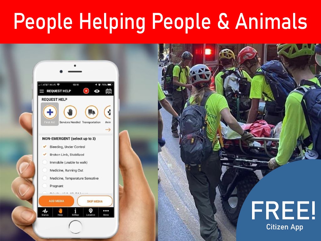
You know your lessons learned without having to go through the suffering. And if you got anything for us you know Hey please leave something in the comments below, check out the pub safe platform You can use the pub safe mobile app to collect and share information without. any fees. If you were an organization like an NGO and you want to use it for dispatching. You know registry organization 90 day free trial give it a whirl See what happens.
we got all kinds of great stuff in here today. And a lot of great stuff on the roadmap That’s really just going to change how a disaster response is done.
you know in coordination logistics volunteer hours, all that kind of stuff is here So thank you And good luck to you especially those that are down in hurricane eons aftermath…
Get the PubSafe Mobile App

Frequently Asked Questions
The communication failures during Hurricane Ian seem overwhelming. As an individual, what can I actually do to help? It’s easy to feel powerless when you see a disaster of this scale, but your personal observations are incredibly valuable. The most effective thing you can do is share real-time information from your location. Reporting a flooded street, a downed tree blocking a road, or a request for a wellness check provides critical intelligence. This information helps create a live, on-the-ground map that first responders, aid organizations, and even your neighbors can use to make safer, more informed decisions when official channels are overwhelmed.
Why does communication break down so easily during a major disaster? Communication fails because disasters dismantle the systems we rely on. Cell towers go down, power grids fail, and roads become impassable, which isolates communities. At the same time, you have dozens of different agencies and volunteer groups trying to coordinate without a shared channel. Information gets stuck in silos, so one team doesn’t know what another is doing. This is why having a single, unified platform is so important; it creates a common space where everyone can see the same information and work together.
My volunteer group wants to be better prepared for the next emergency. What is the most important first step? The most important step is to establish your communication and coordination plan before a disaster strikes. This means deciding how your team will receive assignments, track progress, and share updates when normal communication methods fail. Getting your organization set up on a response platform allows you to manage your members, create teams, and practice how you’ll operate. When you have that structure in place ahead of time, you can deploy faster and work more effectively from the moment you’re needed.
The list of “lessons learned” is long and involves huge logistical changes. Where should communities even begin? You’re right, the list is daunting. The best place to start is with the foundation of all response efforts: unified communication. Before you can stage massive supply depots or coordinate evacuations, you need a reliable way for all parties, from citizens to government agencies to NGOs, to talk to each other. By implementing a shared platform, a community creates a central nervous system for its response. This single step makes tackling all the other logistical challenges more manageable.
What made the storm surge from Hurricane Ian so uniquely destructive? While high winds caused immense damage, the storm surge was particularly catastrophic because of its sheer height and force. In some areas, a wall of water 10 to 15 feet high moved inland, which is powerful enough to sweep entire houses off their foundations. This wasn’t just rising water; it was the ocean forcefully invading coastal communities. The surge inundated areas that had never flooded before, cutting off escape routes and making rescue operations extremely difficult.
Key Takeaways
- Real-time information is a lifeline: Hurricane Ian showed that communication breakdowns, such as delayed evacuation orders, can have devastating consequences. A unified platform for sharing live updates prevents information silos and helps everyone make smarter, faster decisions.
- A disaster’s impact is multi-layered: The threat doesn’t end when the storm passes. Recovery involves tackling secondary crises like collapsed infrastructure, power outages, and public health risks, which requires a comprehensive and adaptable response plan.
- Effective response requires true collaboration: Piecemeal efforts are inefficient. The best way to manage recovery is by connecting citizens, volunteer groups, and official agencies on one platform to map damage, coordinate aid, and get resources where they’re needed most.
Related Articles
- Hurricane Ian Lessons: Key Takeaways & Recovery Insights | PubSafe
- How Communities Can Respond To Hurricanes: A Complete Preparedness & Recovery Guide
- Community Hurricane Preparedness & Recovery Strategies | PubSafe
- Top Challenges In Disaster Response – Overcoming & Preparing
- Top Challenges in Disaster Response & How to Overcome Them | PubSafe